

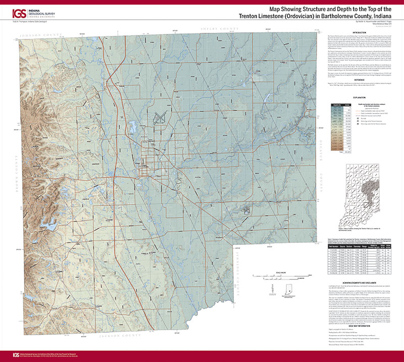
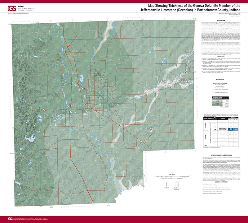
The Trenton Field located in east-central Indiana (fig. 1) was America’s first giant oil field and the focus of an oil and gas boom that started in the late nineteenth century (Rupp, 2017). Thousands of wells were drilled to fuel industries that were attracted to the region by this abundant energy resource. Unregulated drilling that wasted much of the resource led to the rapid decline in production in the Trenton Field in the early twentieth century. While significantly depleted, the field still contains active oil and gas wells. The greatest concentration of wells is centered in Wells and Grant Counties, but the field extends south into Decatur County (fig. 1) where wells are still producing small quantities of gas from the Trenton Limestone (Ordovician). Some of these wells are less than a mile from the eastern boundary of Bartholomew County.
Hasenmueller, W. A., and Rupp, R. F., 2017, Map showing structure and depth to the top of the Trenton Limestone (Ordovician) in Bartholomew County, Indiana: Indiana Geological Survey Miscellaneous Map 109, scale 1:48,000.
You may also like:

Keywords: map, structural geology, Trenton Limestone, Trenton Field, Bartholomew County, hydrocarbon
Can't find what you're looking for? Feel free to contact us directly:
Indiana Geological and Water Survey
1001 E. 10th St.
Bloomington, IN 47405
812-855-7636 (phone)
812-855-2862 (fax)
IGWSinfo@indiana.edu
IGS Return Policy
- Original sales receipt required.
- Returns accepted within 30 days of purchase date.
- Refund will be issued by the same method of payment as purchased.
- Products must be returned in the same new condition as purchased.
- Refunds on custom orders and digital products are NOT allowed.
- Customers are responsible for paying shipping costs to return products.
Updated 8/19/2020