

 Figure 1.
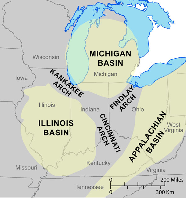
 Map showing regional tectonic features.
The principal
The dip of the bedrock ranges from 10 ft per mile in the southern part of the Allen County to 30 ft in the northeastern part of the county (Fleming, 1994).
The dip of the rock is influenced by the position of Allen County in relation to two structural features: the
Rupp and others (1994) mapped several
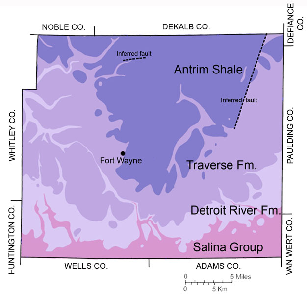 Figure 2.
 Map showing the bedrock geology of Allen County. From Fleming (1994).
Nowhere in the county is bedrock exposed at the land surface. In the northwestern part of the county, the bedrock is covered by as much as 300 ft of
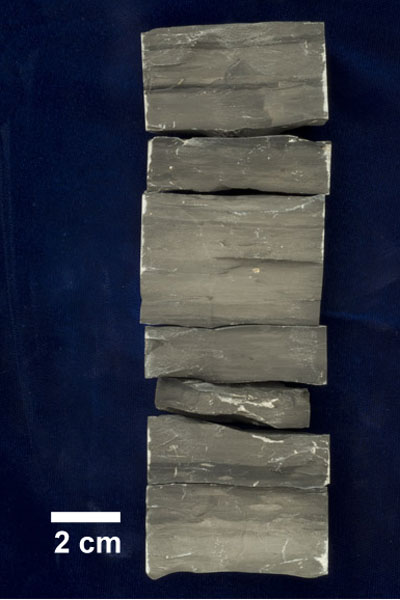
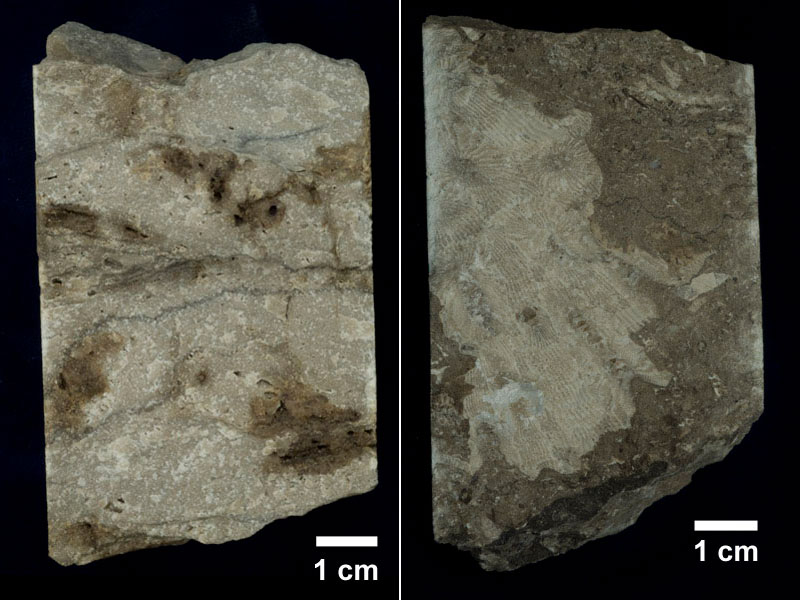
Four rock units have been mapped by Fleming (1994) in Allen County (fig. 2). Information about the characteristics of the buried bedrock units is obtained by geologists through the examination of drill cuttings and cores, geophysical logs taken from well bores, and rock exposures in limestone quarries in the county (fig. 3). The youngest unit exposed at the bedrock surface is the Upper Devonian Antrim Shale (fig. 4).
The Antrim is predominantly brownish-black shale; however, in some places medium-gray
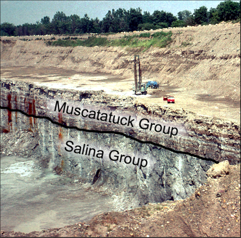 Figure 3.
 An exposure of limestone and dolomite of the Muscatatuck Group (Devonian) and the Salina Group (Silurian) in a quarry in Allen County. The contact between the units is shown by a black line.
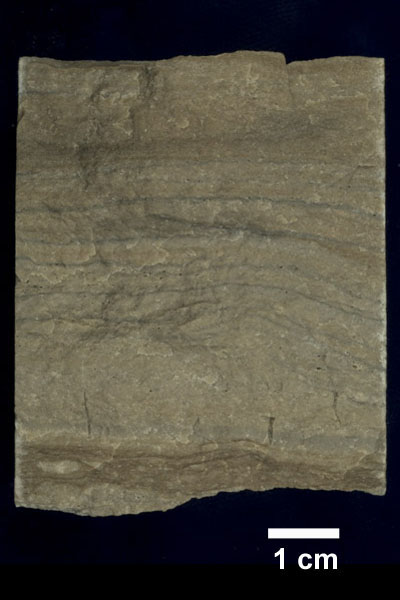
The Traverse Formation (Devonian) consists of a variety of limestones, some dolomite, and thin shale beds (Droste and Shaver, 1986a) and unconformably overlies the Detroit River Formation. The unit reaches a maximum thickness of about 75 ft in northern Allen County (Fleming, 1994). The Detroit River Formation (Devonian) is composed of dolomite, limestone, and evaporite rocks (gypsum and anhydrite) (Droste and Shaver, 1986b). The thickness of the Detroit River ranges from 35 ft in southern Allen County to 70 ft in the northern part of the county (Fleming, 1994).
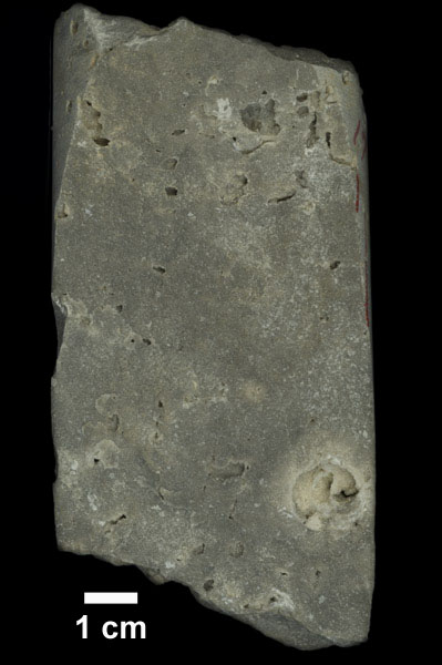
The oldest unit at the bedrock surface in Allen County is the Salina Group of Silurian age. The Salina includes a variety of dominantly carbonate rocks ranging from fine-grained shaly rocks to coarse-grained fossiliferous rocks Droste and Shaver, 1986c). The unit forms the bedrock surface in southernmost Allen County and ranges from 400 to 600 ft in thickness (Fleming, 1994).
The dolomitic limestone bedrock and the sand and gravel in the overlying glacial sediment are sources of aggregate in Allen County (Moore and Ault, 1978). Crushed stone is used as fundamental materials for most structures and roads in Indiana.
| System | Group | Formation | view image |
|---|---|---|---|
|
|
Antrim Shale | Core Example | |
| Muscatatuck Group | Traverse Formation | Core Example | |
| Detroit River Formation | Core Example | ||
|
|
Salina Group | Wabash Formation |
Salina Group Core |
| Pleasant Mills Formation | |||
|
Figure 4. Stratigraphic column showing the relationships of Paleozoic rock-units that occur in Allen County. Additional stratigraphic information about these units can be found at the Indiana Geological Survey Indiana Geologic Names Information System Web page. | |||
References:
Bleuer, N. K., and Moore, M. C., 1978, Environmental geology of Allen County, Indiana: Indiana Geological Survey Special Report 13, 72 p.
Droste, J. B., and Shaver, R. H., 1986a, Traverse Formation, in Shaver, R. H., and others, 1986, Compendium of Paleozoic
rock-unit stratigraphy in Indiana-a revision: Indiana Geological Survey Bulletin 59, p. 156-157; Indiana Geological Survey Web page,
date accessed March 8, 2007.
Droste, J. B., and Shaver, R. H., 1986b, Detroit River Formation, in Shaver, R. H., and others, 1986, Compendium of
Paleozoic rock-unit stratigraphy in Indiana-a revision: Indiana Geological Survey Bulletin 59, p. 35-37; Indiana Geological Survey Web page,
date accessed March 8, 2007.
Droste, J. B., and Shaver, R. H., 1986c, Salina Group, in Shaver, R. H., and others, 1986, Compendium of Paleozoic
rock-unit stratigraphy in Indiana-a revision: Indiana Geological Survey Bulletin 59, p. 133-135; Indiana Geological Survey Web page,
date accessed March 8, 2007.
Fleming, A. H., 1994, The hydrogeology of Allen County, Indiana–a geologic and ground-water atlas: Indiana Geological Survey Special Report 57, 111 p.
Hasenmueller, N. R., 1986, Antrim Shale, in Shaver, R. H., and others, 1986, Compendium of Paleozoic rock-unit stratigraphy
in Indiana-a revision: Indiana Geological Survey Bulletin 59, p. 5; Indiana Geological Survey Web page, date accessed March 8, 2007.
Moore, M. C., and Ault, C. H., 1978, Mineral Aggregates, in Bleuer, N. K., and Moore, M. C., 1978, Environmental geology
of Allen County, Indiana: Indiana Geological Survey Special Report 13, p. 21-31.
Orr, R. W., 1971, Conodonts from Middle Devonian strata of the Michigan Basin: Indiana Geological Survey Bulletin 45, 110 p.
Rupp, J. A., 1997 [Copyright date], Tectonic features of Indiana: Indiana Geological Survey Web page,
<https://igs.indiana.edu/structuralFeatures/tectonic.cfm>,
date accessed March 21, 2007.
Rupp, R. F., Steen, W. J., and Fleming, A. H., 1994, Map of Allen County, Indiana showing the topography and geology of the bedrock surface,
in Fleming, A. H., The hydrogeology of Allen County, Indiana-a geologic and ground-water atlas: Indiana Geological
Survey Special Report 57, plate 2.
Indiana Geological Survey Geologic Names Committee, 2009, Geologic Names Information System: Indiana Geological Survey Web page, <https://igs.indiana.edu/geology/geologicNames/>, date accessed October 21, 2013.