

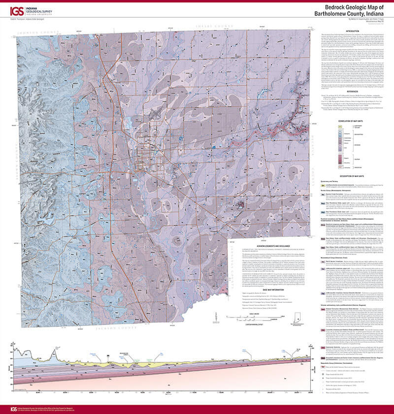
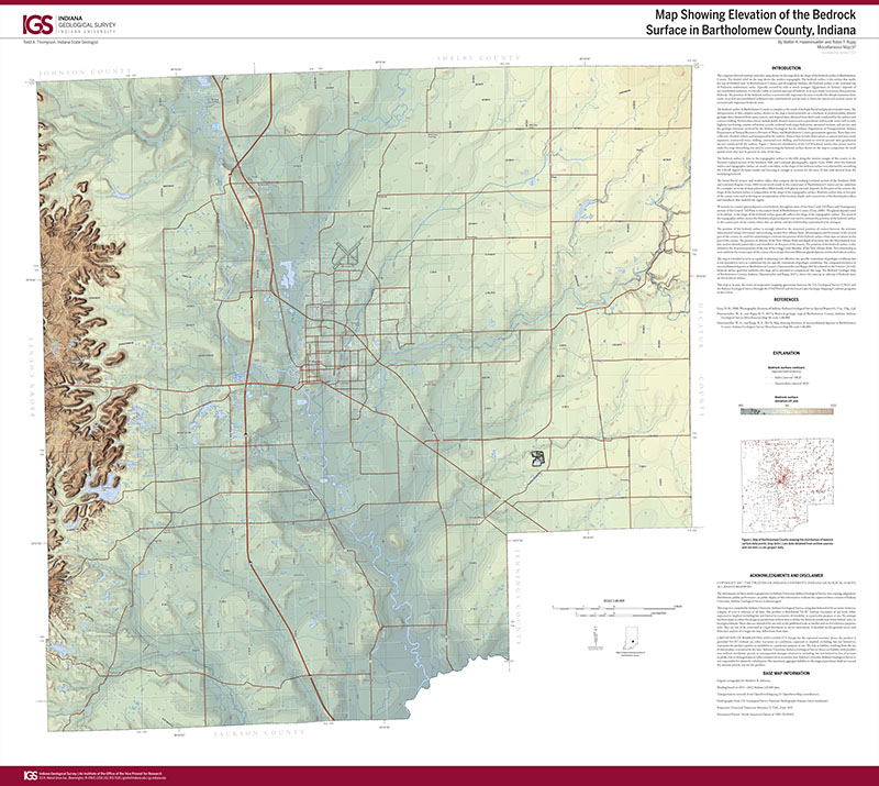
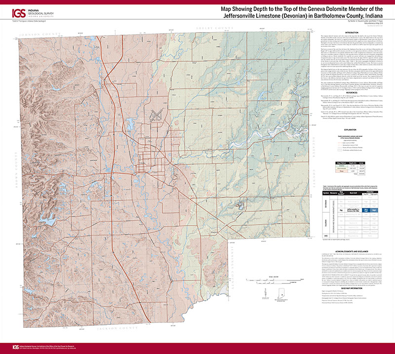
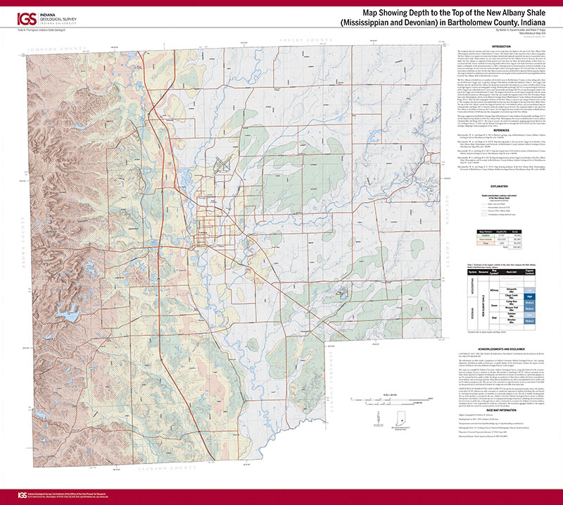
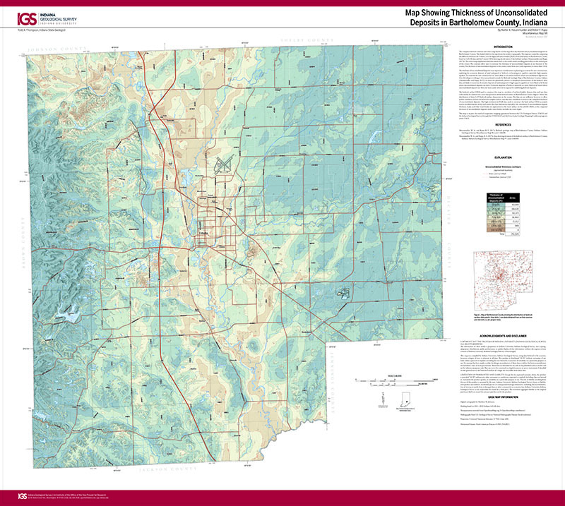
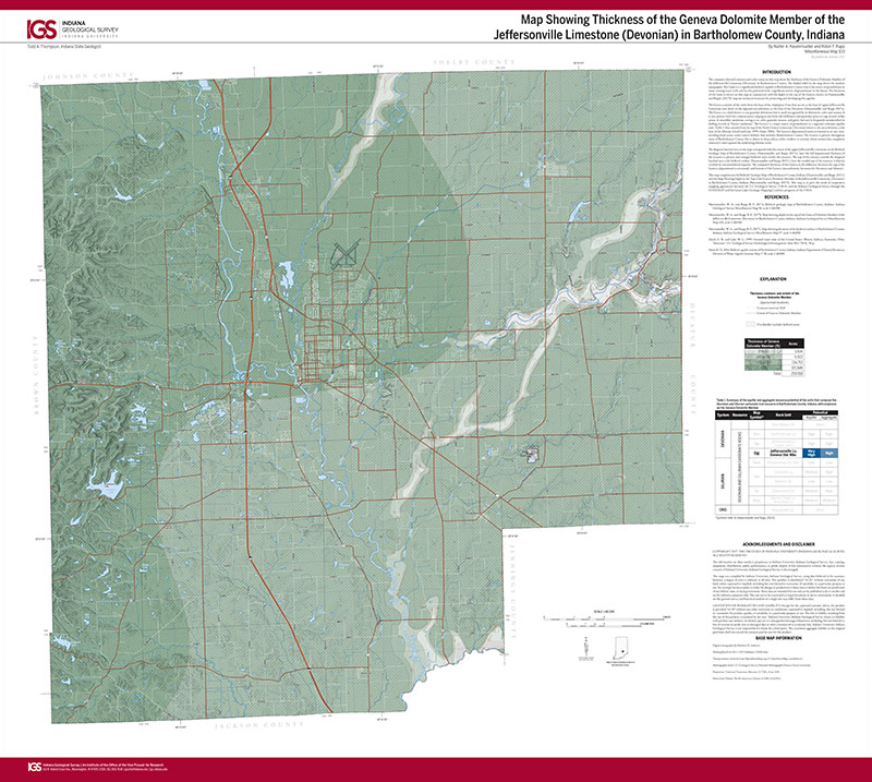
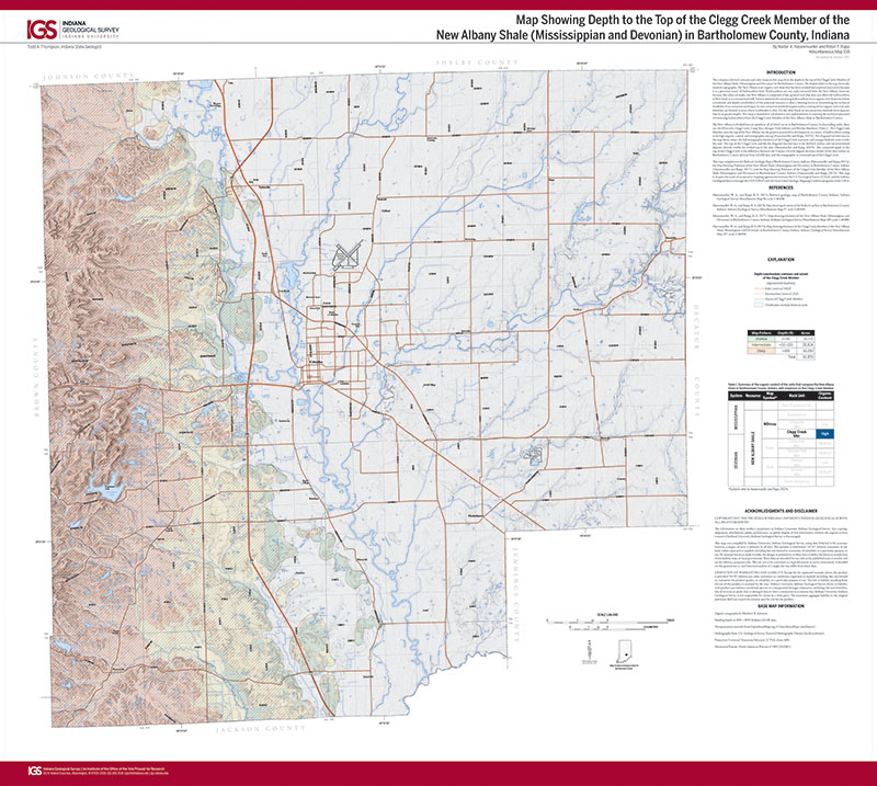
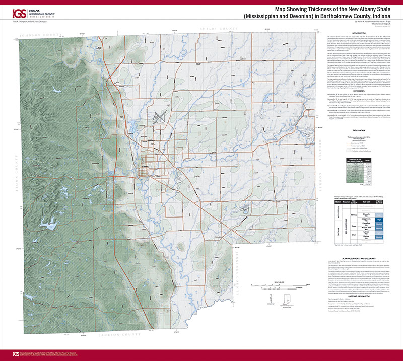
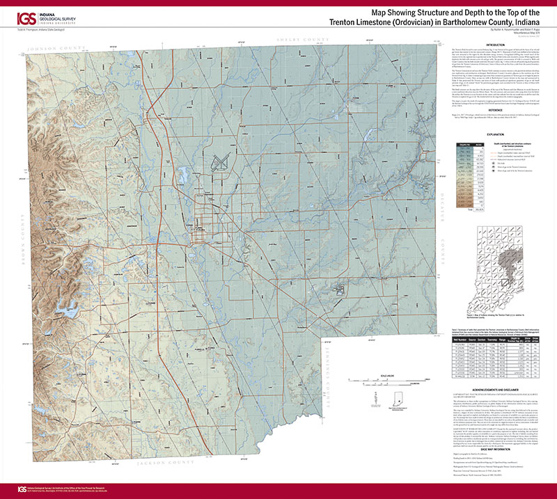
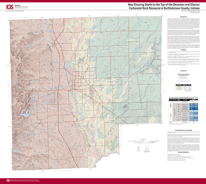
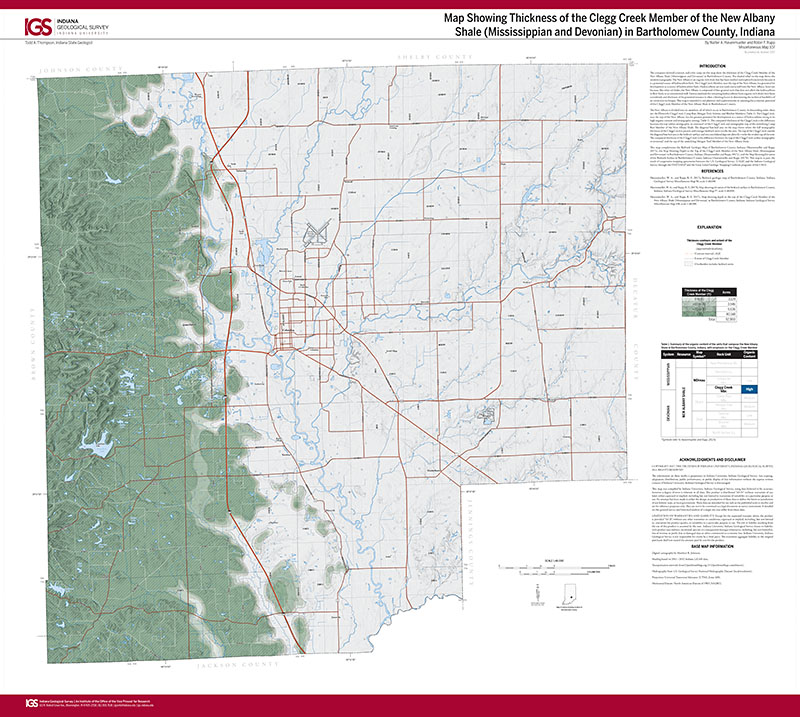
This map presents basic bedrock geological information that contributes to the characterization of potential mineral resources and bedrock aquifer systems in Bartholomew County. The map is a synthesis of archived public domain geological data obtained from many different sources, original data obtained from field work conducted by the authors, and contract drilling supported by project funds. Archive data sources include petroleum-well records, water-well records, engineering borings, refraction seismic surveys, soil surveys, the field notes and field maps of geologists who previously worked in or near Bartholomew County, and the geological literature. Project data includes observations at natural and man-made exposures, contracted rotary drilling, contracted core drilling, and horizontal-to-vertical spectral ratio geophysical surveys conducted by the authors.
Hasenmueller, W. A., and Rupp, R. F., 2017, Bedrock geologic map of Bartholomew County, Indiana: Indiana Geological Survey Miscellaneous Map 96, scale 1:48,000.
You may also like:

Keywords: map, geologic map, bedrock geology, Bartholomew County
Can't find what you're looking for? Feel free to contact us directly:
Indiana Geological and Water Survey
1001 E. 10th St.
Bloomington, IN 47405
812-855-7636 (phone)
812-855-2862 (fax)
IGWSinfo@indiana.edu
IGS Return Policy
- Original sales receipt required.
- Returns accepted within 30 days of purchase date.
- Refund will be issued by the same method of payment as purchased.
- Products must be returned in the same new condition as purchased.
- Refunds on custom orders and digital products are NOT allowed.
- Customers are responsible for paying shipping costs to return products.
Updated 8/19/2020