

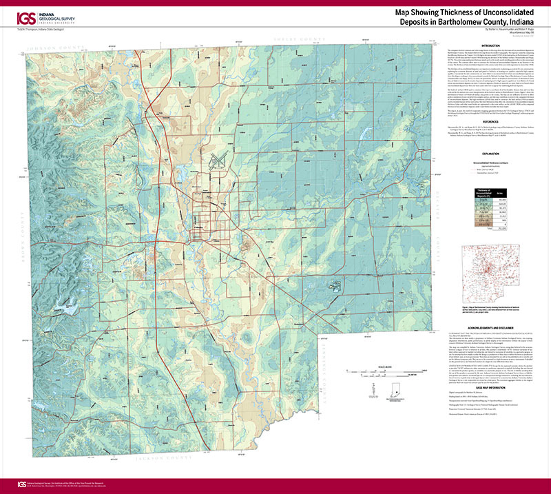
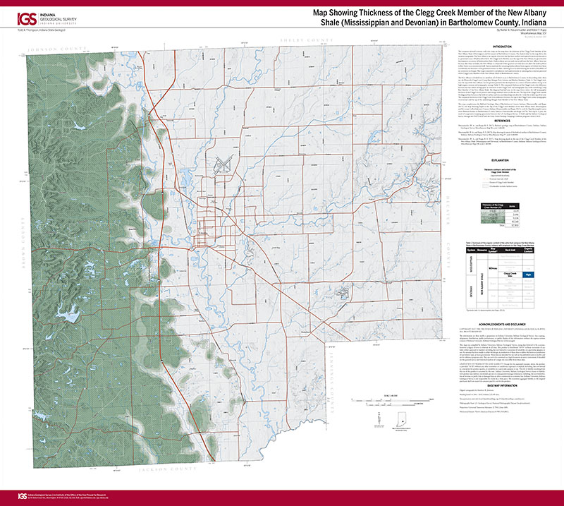
The computer-derived contours and color ramp shown on this map show the thickness of unconsolidated deposits in Bartholomew County. The shaded relief on the map shows the modern topography. The map was created by computing the difference between the 5-meter (16.4-ft) digital elevation model (DEM) of the land surface in Bartholomew County based on LiDAR data and the 5-meter DEM showing the elevation of the bedrock surface (Hasenmueller and Rupp, 2017b). The color ramp emphasizes thickness trends such as the north-south-trending paleovalleys in the central part of the county. The contours allow users to estimate the thickness of unconsolidated deposits at any location in the county. The thickness of unconsolidated deposits in the county varies from zero (rock exposures) to more than 150 ft.
Hasenmueller, W. A., and Rupp, R. F., 2017, Map showing thickness of unconsolidated deposits in Bartholomew County, Indiana: Indiana Geological Survey Miscellaneous Map 98, scale 1:48,000.
You may also like:

Keywords: map, unconsolidated deposits, thickness, Bartholomew County
Can't find what you're looking for? Feel free to contact us directly:
Indiana Geological and Water Survey
1001 E. 10th St.
Bloomington, IN 47405
812-855-7636 (phone)
812-855-2862 (fax)
IGWSinfo@indiana.edu
IGS Return Policy
- Original sales receipt required.
- Returns accepted within 30 days of purchase date.
- Refund will be issued by the same method of payment as purchased.
- Products must be returned in the same new condition as purchased.
- Refunds on custom orders and digital products are NOT allowed.
- Customers are responsible for paying shipping costs to return products.
Updated 8/19/2020