Principles of GIS
The LakeRim map is a geographic information system (GIS) that allows users to compose customized maps consisting of any combination of more than
175 layers of information. A layer is a map that shows data for a single subject matter (theme). Examples of layers include:
- Points showing cities
- Lines showing roads
- Polygons showing soil types
- Images showing topographic relief
In addition to displaying spatial data as layers, a GIS can be used to retrieve lists of descriptive information (attributes) about the geographic
features in a layer. For example, when viewing a map of cities, you may point to any given city with your cursor and retrieve the population data
for that city.
Map > Layers.
Click this menu item to display the table of contents in
the frame to the right of the map.
The map layers are organized thematically in folders. Click the folder icons to expand or close the
folders and to view the map layers contained in the folders.
Check the box next to a layer's name to make that layer visible in the map.
Next, click the Refresh Map button to redraw the map, including any new layers that have been checked on. To make the map refresh automatically each time a layer is
checked on or off, check the "AutoRefresh Map" box below the layer tree.
Some layers are visible only within a specified range of view-scales. Such layers are marked with the
 icon. Hover your mouse
pointer over the icon to determine the range of viewable scales for
scale-dependent layers. icon. Hover your mouse
pointer over the icon to determine the range of viewable scales for
scale-dependent layers.
To view metadata for a layer of interest,
click the  icon. icon.
Clicking the  icon shows or hides the layer's legend. icon shows or hides the layer's legend.
Map > Legend.
Click this menu item to display legends for visible map layers.
Map > Bookmarks.
Click this menu item to create a bookmark for your
customized map or to retrieve a previously created bookmark. When you
click this menu item, the "Bookmarks" dialog box will appear in the frame
to the right of the map.
To save your customized map on your
computer, type in a bookmark name and click the "Create" button. Your new
bookmark will appear in a list titled "Saved bookmarks."
To return
to a customized map that was previously bookmarked, click on its name in
the list of saved bookmarks.
Existing bookmarks can be deleted by
clicking the red X next to their names.
NOTE: This tool uses
Internet cookies to save your bookmarked maps. If this tool is not
functioning properly, your Web-browser settings for cookies may be
disabled. If you wish to use the "Bookmarks" function, set your browser to
enable cookies.
Map > Hyperlinks.
Click this menu item to save your customized map as
a Web hyperlink that can be shared with other users. When you click this
menu item, the "Generate a Map Hyperlink" dialog box will appear in the
frame to the right of the map.
Click the "Generate Link" button,
and a hyperlink will appear in the text box above the button. You can then
copy and paste the hyperlink from the text box into a document or e-mail
message.
NOTE: This tool may not work with browsers other than
Internet Explorer.
Map > Overview.
Click this menu item to hide or show the small index
map in the upper-left portion of the interactive map.
Search/Query > Query Layers.
Click this menu item to
query the database associated with a particular layer.
When you
click this menu item, the "Query" dialog box will appear in the frame to
the right of the map.
Select the layer that you wish to query by
using the "Active Layer" dropdown box.
Select the field that you
wish to query from the "Field" dropdown box.
Select the operator
that you wish to use from the "Operator" dropdown box.
Enter the
value of the feature that you wish to find in the "Value" text box. Use
the "Get Samples" button to obtain sample values. If the particular value
in which you are interested does not appear in the list, enter your
desired value using the same format as the samples.
To complete the
simple query string, click the button labeled "Add to Query String" and
then click the "Execute" button.
Your desired feature should then
be highlighted on the map in blue, and a new browser window named
"Query/Selection Results" will appear.
NOTE: More complex queries
can be built and executed by using the "And," "Or," "Not," and parenthesis
buttons to construct a compound query, followed by use of the "Add to
Query String" and "Execute" buttons.
Draw > Text or Markers.
Click this menu item to place
custom text and (or) markers on the map.
After you select the tool,
the "Add Text or Marker" dialog box will appear to the right of the
map.
Choose whether you want to place a marker (that is, a point
symbol) or text, or both. If the "Add Point Symbol" option has been
chosen, one of five symbols can be specified from the dropdown box. Using
the "Add Text" option, you can add either a comment or coordinates of a
particular location on the map. Coordinates can be displayed either in map
projection (UTM Zone 16 NAD83) or in degrees, minutes, and
seconds.
Once you have chosen the options, click the map to define
the desired location. Then click the "Add Graphics" button and the symbol
and its associated text will appear on the map.
If both text and
marker are placed on the map, the text will be centered below the marker.
If only text is added, the label will appear immediately to the right of
the click location.
Any number of text and marker labels can be
placed on the map. To remove labels from the map, press either the "Remove
Last" or "Remove All" button that is beneath "Manage text and/or marker
graphics." Similarly, to remove graphic shapes, press either the "Remove
Last" or "Remove All" button that is beneath "Manage line or polygon
graphics."
Draw > Shapes.
Click this menu item to place custom lines and polygons
on the map. Labels providing lengths and areas associated with the lines
and polygons can also be added.
After you select the tool, the "Add
Shape (Line or Polygon Graphic)" dialog box will appear to the right of
the map. Start by clicking on the map to add a point. Continue to sketch a
line on the map one point at a time. Click the "Delete Last Point" button
to delete the last point added to the map, or the "Restart" button to
erase the entire line.
To add the sketched line as a permanent
graphic, click either the "Complete Line" or "Complete Polygon" button.
Line style, width, color, and fill style (for polygons) can be set.
Optionally, length or area measurements can be added.
To add a
circle to the map, click on the map to place either one or two points. If
one point is added, specify radius and distance units and generate a
circle graphic by clicking the "Add Circle by Point and Radius" button.
The point becomes the center of the circle. If two points are placed,
click the "Add Circle by 2 Points" button. The first point becomes the
circle's center, while the second point determines the circle's radius.
Circle center and radius measurements can be added.
To erase text
and marker graphics or line and polygon graphics, click the "Remove Last"
or "Remove All" button. The measurements, radius, and circle-center marker
are added as separate text/marker graphics and therefore are deleted
separately from line and polygon graphics.
Draw > Clear Selection.
This menu item will clear selected features and
remove lines and text drawn on the map with the "Measure Distance" and
"Measure Area" tools.
To remove text and markers created with the
"Text and Markers" tool or lines and polygons created with the "Shapes"
tool, you must use the "Remove Last" or "Remove All" button included in
the tool's dialog box.
Map Output > Generate Layout for Printing.
Click this menu
item to create a layout (in a new browser window) to create a layout to
send to a printer.
After you select the tool, the "Generate Layout
for Printing" dialog box will appear to the right of the map. Follow the
steps described below to generate the map layout.
1. Specify map properties.
a. Map size and orientation. Select the
size and orientation of your map.
b. Map extent. Use the "Preserve scale" option to keep the scale of the printed map the
same as that of the online map. The area covered by the printed map will
not match the area covered by the online map. Both printed and online
maps, however, will always be centered on the same location. Since the
scale of the map remains the same, the visibility of scale-dependent
layers in the printed map does not change. If the "Preserve extent" option
is used, the online map is fit into the extent of the printed map. The
area covered by the map remains the same, but the scale of the map
changes. Layers that are scale-dependent that are visible in the online
map may not be visible in the printed map because of the change of
scale.
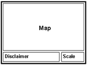
c. Map elements. Select the "Map image
only" option to maximize the map area in the print layout. The layout will
contain map, disclaimer, and map scale.
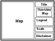
Select the "Add map
elements" option if you wish to add additional elements to the map. These
elements are optional and include "Title," "Overview map," and "Legend."
You can control which layers will appear in the legend by selecting them
in the list.
2. Generate map
layout.
Click the Print Map button to create map layout. You may have
to wait up to 20-30 seconds, depending on map size you selected.
3.
Set page options.
In the new browser window that contains the map
layout, go to "File > Page Setup." The following parameters must be
set:
a. Paper size. This browser parameter must
match the page size you selected when creating your custom layout. The
default page size is "Letter" (8.5 x 11 in.).
b. Page orientation. This browser parameter ("Portrait" or
"Landscape") must match the page orientation you chose when creating your
custom layout. Page orientation always defaults to
"Portrait."
c. Page margins. This browser
parameter must be set to 0.5 inches (or less) for all four sides. This
change need only be done once because Internet Explorer retains the last
values entered for margin settings.
d. Printer. To print your map on a printer that is not set as your default printer,
click the "Printer" button and select a different printer. NOTE: when
changing your printer, you may need to reset the page size, page
orientation, and page margins.
4. Preview your map.
Go to "File > Print Preview" to verify that your map fits the page size you
selected. If the page is cut off at the right or at the bottom, try the
following:
a. Double-check your Internet Explorer page
options: page size, page orientation, and page margins. Size and
orientation should match those you selected for your map. Margins should
be set to 0.5" on each side.
b. If the map still does
not fit on one page and is cut off at the bottom, the map legend may be
causing the problem. If your map contains many layers, or if some layers
have many symbols, the area occupied by the legend may spill onto a second
page. To solve this issue, reduce the number of layers to be included in
the legend, change orientation to portrait, increase the page size, or
eliminate the legend from the map layout altogether.
5. Print the
map.
If the print preview shows that the map fits the page correctly,
then go to "File > Print" to send the map to the printer.
Map Output > Save Map as JPG.
Click this menu item to export your
customized map to a JPEG file.
After you select this tool, the
"Save Map as JPEG Image" dialog box will appear to the right of the
map.
Select your desired size and orientation and click the
"Generate Image" button. Note that the scale and the center of the JPEG
image are the same as those of the map in the viewer. The image loads in a
new browser window. To generate your JPEG file, right-click on the image
and choose "Save Picture As."
Help > Request Support.
Click this menu item to submit a request for technical support, report a bug, or request an enhancement to the site.
Map Tools & Buttons
|
Menu. Click this menu to link to this page. |
 |
Download dataset. Click on this button to view metadata for a layer of interest. |
|
Viewable scale.
Click on this button to download a layer of interest. You will download a WinZip file that contains a shapefile of the layer, together with metadata for the layer.
|
 |
Zoom In.
Some layers are only visible within a specified range of view-scales. Hover your mouse pointer over this button to determine the range of viewable scales for scale-dependent layers.
|
 |
Zoom Out.
Select this tool and draw a box around your area of interest. To zoom by a factor of two on a particular location, simply click on the map.
|
 |
Zoom to Full Extent.
Select this tool and draw a box to zoom out. The smaller the box, the farther the map will zoom out. To zoom out by a factor of two, simply click on the map.
|
 |
Zoom to Location or Area.
Click this button to redraw the interactive map at its original extent.
When you click this button, the "Zoom to Location or Area" dialog box will appear in the frame to the right of the map.
Use this dialog box to zoom to a county, city, quadrangle, township, or section of interest.
In order to zoom to a county of interest, use the dropdown box to select the county and then press the "Zoom" button.
In order to zoom to a city or quadrangle of interest, enter the first three letters of the name into the appropriate query box followed by a
percent sign ("%"). Press the "Search" button and select the city or quadrangle from the dropdown box. Then press the
"Zoom" button.
In order to zoom to a township or section, select the township, range, and section from the dropdown boxes. Then press the "Zoom"
button. In order to view an entire township, select the value "All" from the "Section" dropdown box.
|
 |
Pan.Select this tool, then click and drag in order to display areas adjacent to current map view. |
 |
Zoom to Last Extent. Click this button to re-draw the map at its previous extent. |
 |
Identify.
This tool lets you view information for a particular feature (point, line, or polygon) of a layer. After selecting the tool, choose the layer of interest from the "Active Layer" drop-down box. Then click on the feature of interest (such as a particular road, city, etc.).
After you have clicked on a feature, a table with the attribute information for the feature will appear in a new browser window. Close this window when you are finished, or it will become hidden behind other windows and may not re-appear on top when you use the Identify tool again.
If you are zoomed out, a single click may select multiple features of a layer. To avoid a clutter of symbols and numbers, you may need to zoom in closer on the feature of interest.
If you have a problem with this tool, check to determine if the problem might be caused by a popup blocker that is utilized by your Web browser.
|
 |
Query.
After you select this tool, the "Query" dialog box will be displayed to the right of the map.
Use this dialog box to locate features within a layer that fulfill criteria that you specify. Before performing the query, be sure to specify the layer of interest as the "Active Layer."
|
 |
Measure Distance.
This tool allows the user to measure distances on the map. Select the tool and click the map to place the starting point. Wait until a red point appears, and then click again to define a second point. A completed line segment with its length will appear. Continue to click other points in order to add and measure more segments. The total length of all connected segments is indicated in parentheses.
To erase lines and text, click the "Clear Selection" button .
|
 |
Measure Area.
This tool allows the user to measure areas on the map. Select the tool and click the map to place the starting point. Wait until a red point appears, and then click again to define a second point. When a third point is added, a polygon formed by the three points appears, together with a number indicating its area. Continue to click the map to further modify the shape of the polygon.
To erase areas and text, click the "Clear Selection" button .
|
 |
Select by Rectangle.
This tool lets you view information about a feature or features (points, lines, or polygons) of a layer. After selecting the tool, choose the layer of interest from the "Active Layer" drop-down box.
Click on a single feature to select it, or draw a rectangle around multiple features to select all of them. All features that completely or partially fall within the rectangle will be selected.
After you have selected the features, a table with the attribute information will appear in a new browser window. Close this window when you are finished, or it will become hidden behind other windows and may not re-appear on top when you use the tool again.
If you have a problem with this tool, check to determine if the problem might be caused by a popup blocker that is utilized by your Web browser.
|
 |
Clear Selection.
This button removes selected features and any lines and text drawn on the map.
|
 |
Draw Text/Markers.
After you select the tool, the "Add Text and Markers" dialog box will be displayed to the right of the map. Use this dialog box to place text and (or) markers on the map.
Choose whether you want to place a marker or text or both. If the Marker option has been chosen, one of five symbols can be specified from the dropdown box. For the Text option, either a comment or coordinates of a particular location can be drawn on the map. Coordinates can be displayed either in map projection (UTM Zone 16 NAD83), or in DMS (Degrees, Minutes, Seconds). Once the options have been chosen, click the map to define the desired location. Then click the "Add Graphics" button and the symbol and its associated text will appear on the map.
Any number of text and marker labels can be placed on the map. To remove all the labels from the map, press the "Clear Selection" button .
Note: If both text and marker are placed on the map, the text will be centered with respect to the marker and positioned below it. If only text is added, the label will be drawn immediately to the right of the click location.
|
 |
Quick Print.
This button opens a new window which contains a printable map. After clicking the button, the user is prompted to enter a title, which will appear at the top of the map. After the title has been entered, press "OK." The map may be printed by selecting the "Print" option from the menu bar of the new window.
|
|
|

