

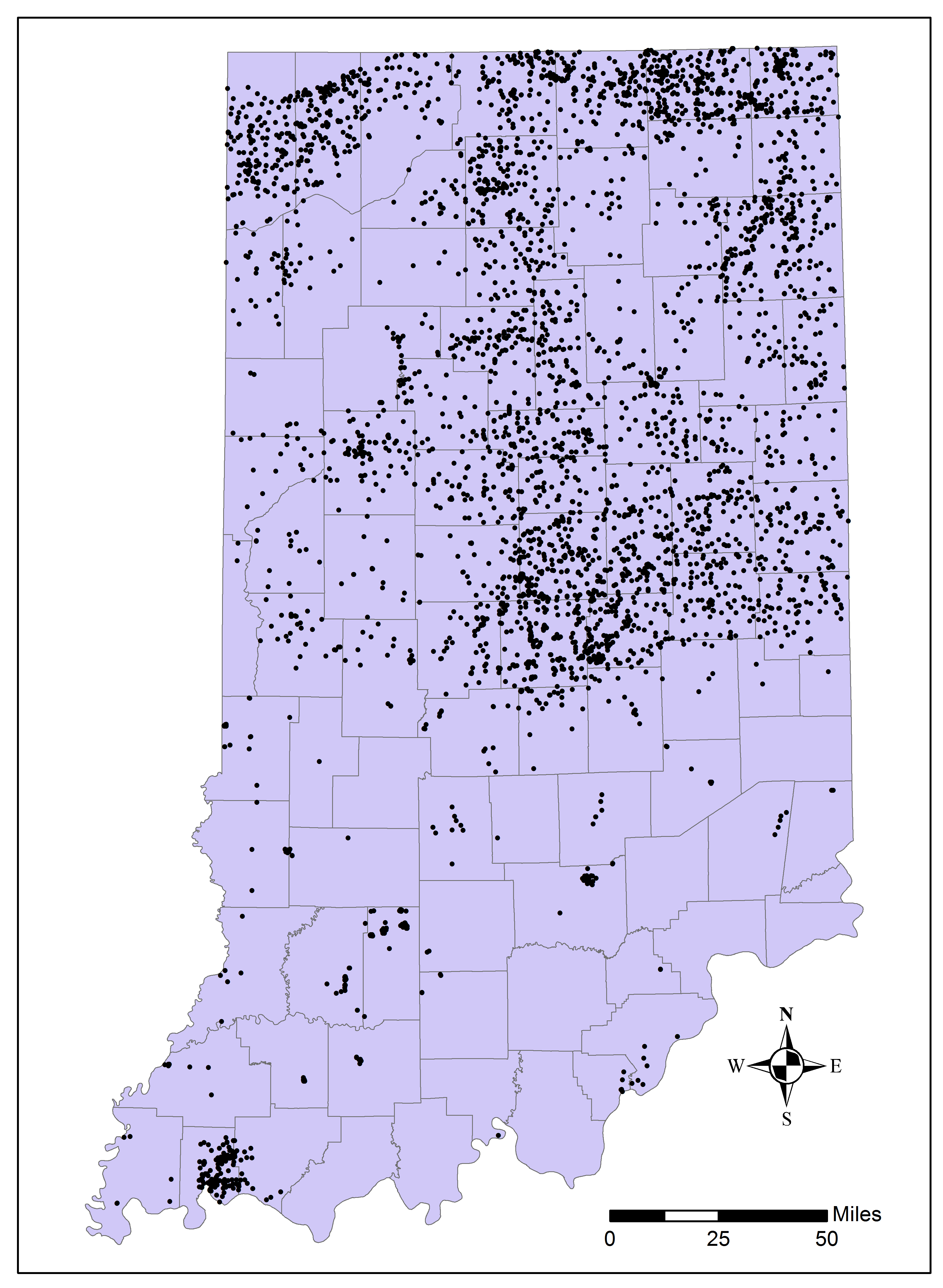
 Figure 1.
Map of Indiana showing the distribution of gamma-logs collected by the IGS. Black dots represent well locations.
Introduction
Downhole logging of unconsolidated
The Indiana Geological and Water Survey (IGWS) began a
Gamma-Ray Log
Gamma-ray logs have two fundamental benefits that make them important to studies of geological materials: (1) they provide a basic analysis of grain size and, (2) they can be collected in any form of cased borehole, above or below water.
Gamma-ray logs record
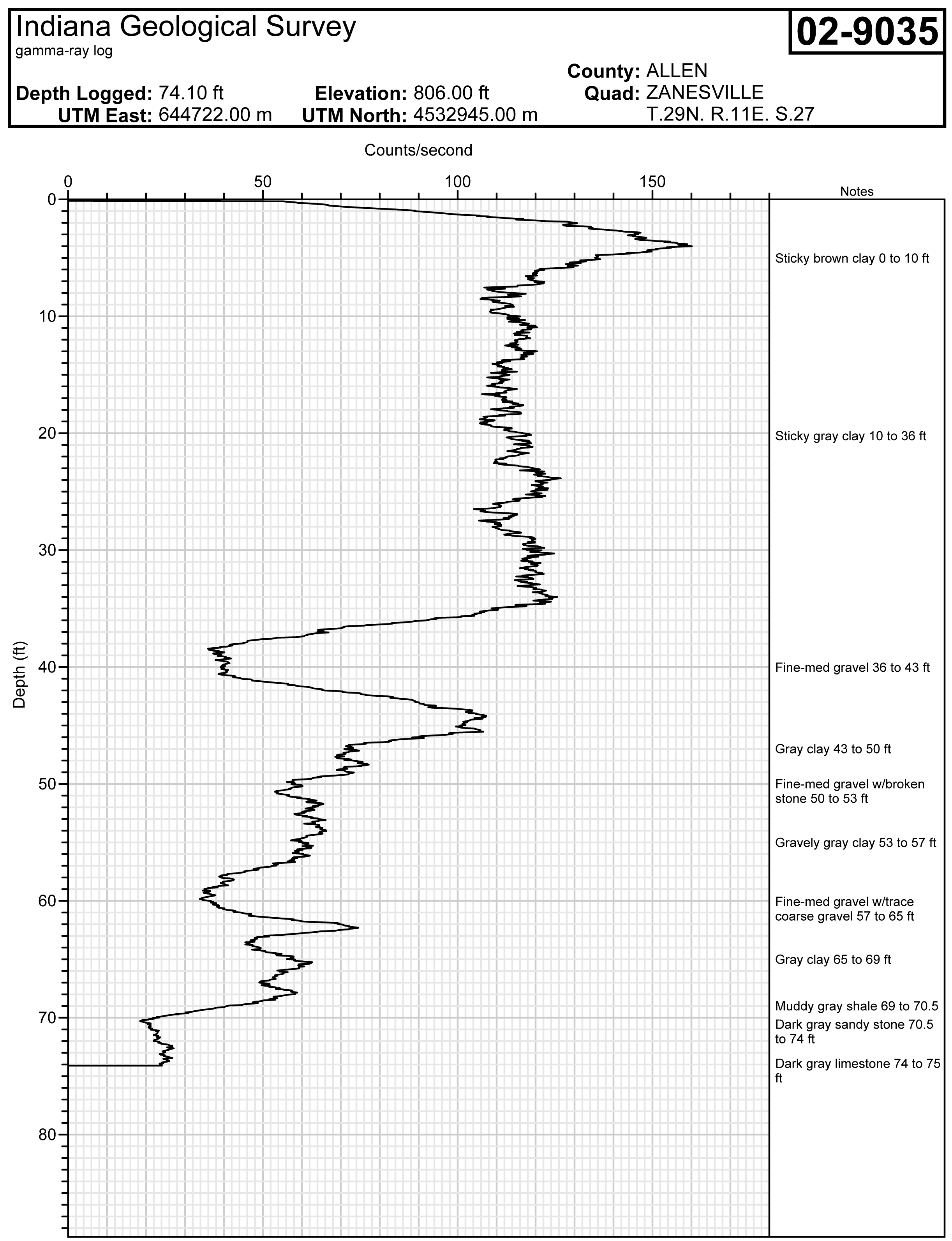 Figure 2.
Gamma-ray log profile in Allen County, showing gamma ray signatures and sediment descriptions of the major glacial sequences.
In midwestern environments, the gamma-ray log measures "shaliness" in
Glacial sediments exhibit variations in depositional processes and environment and will therefore display a typical log profile (fig. 2). Sediments with uniform physical properties, such as some glacial tills, tend to produce a correspondingly uniform gamma-ray profile. In contrast, sediment assemblages with wide variations in grain sizes (sand and gravel), or characterized by interstratification of fine- and coarse-grained sediment such as debris flows, will display a less uniform gamma-ray profile. These characteristics can be used to identify and trace individual units and sediment assemblages in the subsurface. They may also assist in interpreting material descriptions on water-well records (Fleming, 1994; Bleuer, 2004).
Glacial-Terrain Mapping
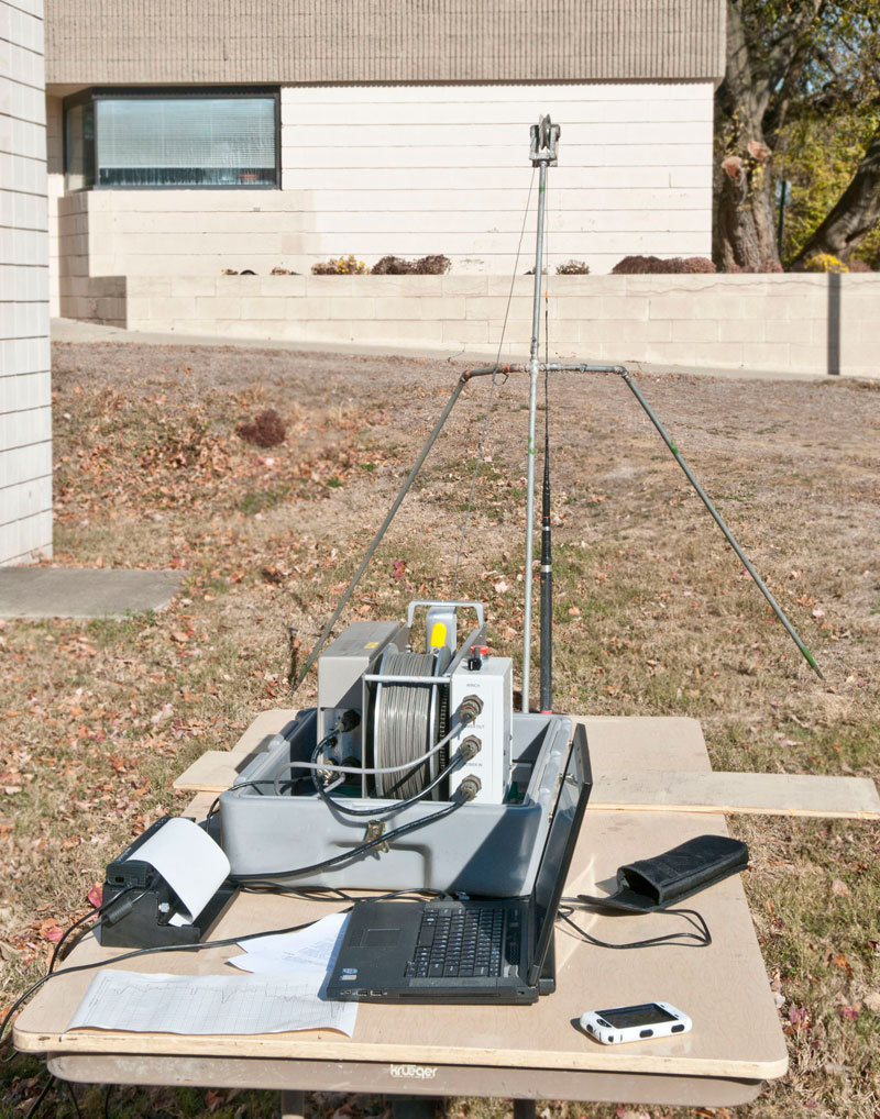 Figure 3.
Field set-up and data collection using the portable gamma-logging unit.
The gamma-ray log is a fundamental component of the IGWS approach to glacial-terrain characterization. For 25 years, IGWS seasonal programs put sampling/logging operations in the field alongside local water-well-drilling contractors throughout the state. IGWS geologists and staff collected cuttings from mud-rotary drill operations on a daily basis throughout the summer field season (May-September) and from contracted test holes. Samples were collected at 2- to 5-ft intervals and at major sediment changes, drained, and stored in paper cups to avoid crushing the clays. IGWS personnel collected gamma-ray logs of the wells prior to pump installation. Current programs focus on contracted test holes and the collection of continuous cores of sediment. Both analog and digital logs are collected in the field (fig. 3). Logs and their corresponding sample sets are analyzed, interpreted, and archived at the IGS.
Allen County
In Allen County, gamma-ray logs were used to show bulk differences in grain size, as well as mode and environment of deposition of the glacial sediments (Fleming, 1994, 1998a, 1998b). The relationship between the gamma-ray log signature and physical properties of the associated sample sets aided in the determination of specific depositional sequences. This relationship was used to help determine and map major glacial aquifers and confining units across the county.
References:
Bleuer, N. K., 2004, Slow-logging subtle sequences-the gamma-ray log character of glacigenic and other unconsolidated sedimentary sequences: Indiana Geological Survey Special Report 65, 39 p.
Fleming, A. H., 1994, The hydrogeology of Allen County, Indiana-a geologic and ground-water atlas: Indiana Geological Survey Special Report 57, 111 p.
Fleming, A. H., 1998a, Using glacial terrain models to define hydrogeologic settings in heterogeneous depositional systems, in Fraser, G. S., and Davis, M. D., eds., Hydrogeologic models of sedimentary aquifers: SEPM Concepts in Hydrogeology and Environmental Geology, v. 1, p. 25-46.
Fleming, A. H., 1998b, Using glacial terrain models to characterize aquifer system structure, heterogeneity, and boundaries in an interlobate basin, northeastern Indiana, in Fraser, G. S., and Davis, M. D., eds., Hydrogeologic models of sedimentary aquifers: SEPM Concepts in Hydrogeology and Environmental Geology, v. 1., p. 47-68.