

| $15.00 | |
| Format(s) | |
|---|---|
| Quantity | |
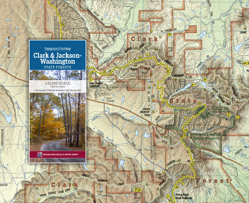
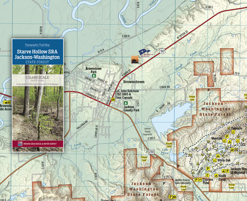
This folding two-sided trail map is printed on waterproof, tear-resistant paper and covers the entire length of the Knobstone Trail as it passes through Clark and Jackson-Washington State Forests, at a scale of 1 inch to 1/2 mile. The Knobstone Escarpment forms the Uplands region of south-central Indiana and contains many opportunities for you to experience the remarkable topography and physiography of the Hoosier State. This area includes the Deam Lake State Recreation Area, Clark State Forest, Jackson-Washington State Forest, state nature preserves, state conservation areas, and fish and wildlife areas. This area offers more than 100 miles of recreational trails in Clark, Scott, and Washington Counties. This map is available digitally through the Avenza Map app at https://www.avenzamaps.com/maps/1096001
Indiana Geological and Water Survey, 2020, Topographic Trail Map--Clark and Jackson-Washington State Forests: Indiana Geological and Water Survey Trail Map 2, scale 1:31,680.
You may also like:


Keywords: State Forest, Knobstone Trail, hiking, map, trail map, recreation
Can't find what you're looking for? Feel free to contact us directly:
Indiana Geological and Water Survey
1001 E. 10th St.
Bloomington, IN 47405
812-855-7636 (phone)
812-855-2862 (fax)
IGWSinfo@indiana.edu
IGS Return Policy
- Original sales receipt required.
- Returns accepted within 30 days of purchase date.
- Refund will be issued by the same method of payment as purchased.
- Products must be returned in the same new condition as purchased.
- Refunds on custom orders and digital products are NOT allowed.
- Customers are responsible for paying shipping costs to return products.
Updated 8/19/2020