

| $15.00 | |
| Format(s) | |
|---|---|
| Quantity | |
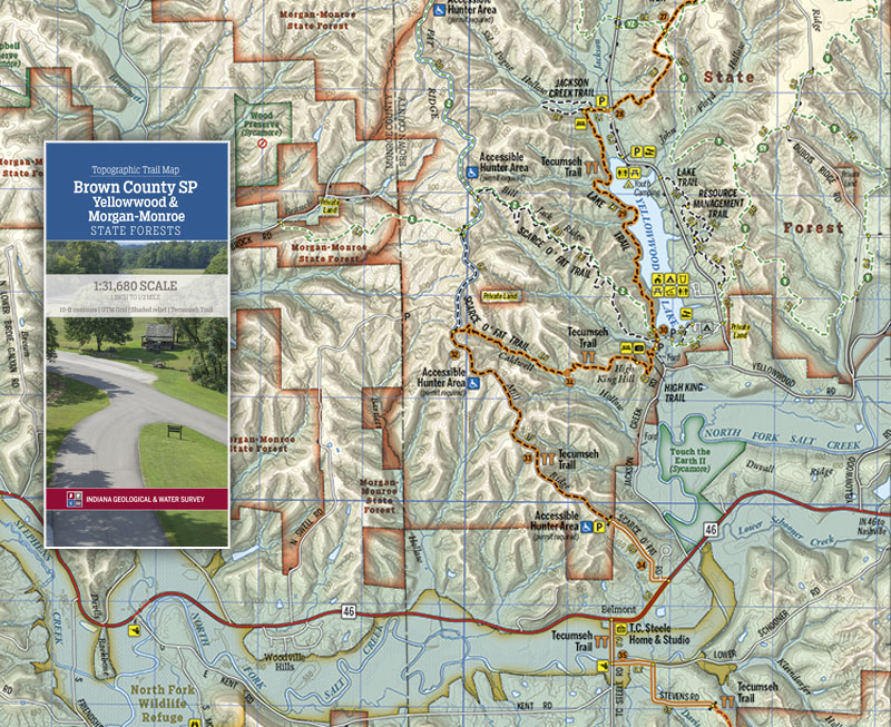
This folding two-sided trail map is printed on waterproof, tear-resistant paper; it covers the rolling hills of Brown County State Park, the forested hills of Yellowwood and Morgan-Monroe State Forests, Paynetown State Recreation Area on Monroe Lake, and the Pate Hollow area of Hoosier National Forest. In addition to these, many smaller nature preserves, county and city parks, and conservation lands offer a variety of recreational activities. With camping, boating, biking, and more than 100 miles of various trails, there are ample opportunities to explore the outdoors. The underlying geology in this region includes the bedrock unit known as the Borden Group; in the eastern portions of the map area, these rocks create the steep hills and narrow valleys that will test even the most seasoned outdoor enthusiast. To the west, the various limestone units feature caves, swallow holes, and sinkholes. This map is available digitally through the Avenza Map app at https://www.avenzamaps.com/maps/1120218.
Indiana Geological and Water Survey, 2020, Topographic Trail Map---Brown County SP and Yellowwood and Morgan-Monroe State Forests: Indiana Geological and Water Survey Trail Map 4, scale 1:31,680.
You may also like:
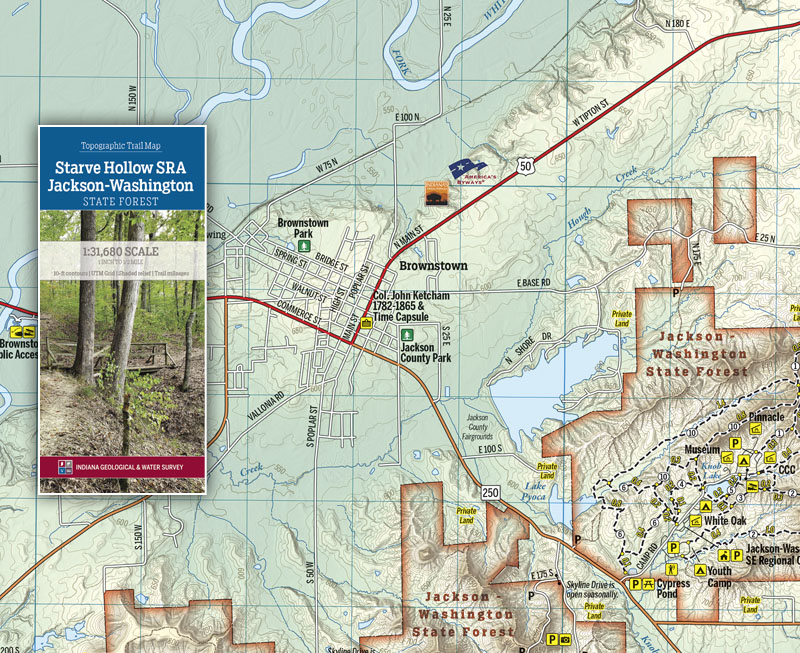


Keywords: state park, State Forest, Borden Group, Uplands region, trail map, hiking, map, recreation
Can't find what you're looking for? Feel free to contact us directly:
Indiana Geological and Water Survey
1001 E. 10th St.
Bloomington, IN 47405
812-855-7636 (phone)
812-855-2862 (fax)
IGWSinfo@indiana.edu
IGS Return Policy
- Original sales receipt required.
- Returns accepted within 30 days of purchase date.
- Refund will be issued by the same method of payment as purchased.
- Products must be returned in the same new condition as purchased.
- Refunds on custom orders and digital products are NOT allowed.
- Customers are responsible for paying shipping costs to return products.
Updated 8/19/2020