

| Not available for purchase | |
| Format(s) | Not Available |
|---|---|
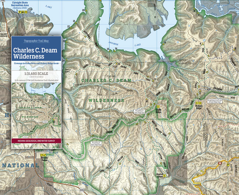
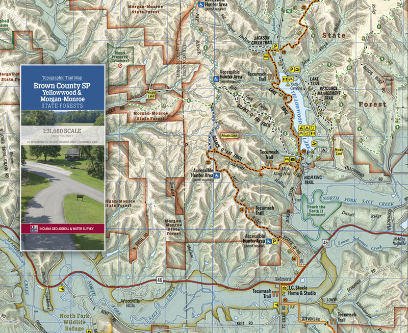
This folding two-sided trail map is printed on waterproof, tear-resistant paper and shows the Charles C. Deam Wilderness, including the Nebo and Hickory Ridge areas, at a scale of 1 inch to 1/2 mile. Experience the remarkable topography and physiography of the Hoosier State, including the Hoosier National Forest, the Charles C. Deam Wilderness, and lands owned by the state of Indiana and Sycamore Land Trust. The wilderness area offers 36 miles of hiking and horseback riding trails that allow visitors to explore a place set aside for restoration to its pre-settlement conditions. This map is available digitally through the Avenza Map app at https://www.avenzamaps.com/maps/931850.
Indiana Geological and Water Survey, 2019, Topographic Trail Map--Charles C. Deam Wilderness: Indiana Geological and Water Survey Trail Map 1, scale 1:31,680.
You may also like:


Keywords: trails, hiking, Charles C. Deam Wilderness, topographic map, trail map, map, State Forest, recreation
This item is no longer available. Please contact the Indiana Geological and Water Survey Publication Sales Office for more information. Many IGWS publications are available through local libraries.
Publication Sales Office
Indiana Geological Survey
1001 E. 10th St.
Bloomington, IN 47405
(812) 855-7636 office phone
(812) 855-2862 office fax
IGSINFO@indiana.edu