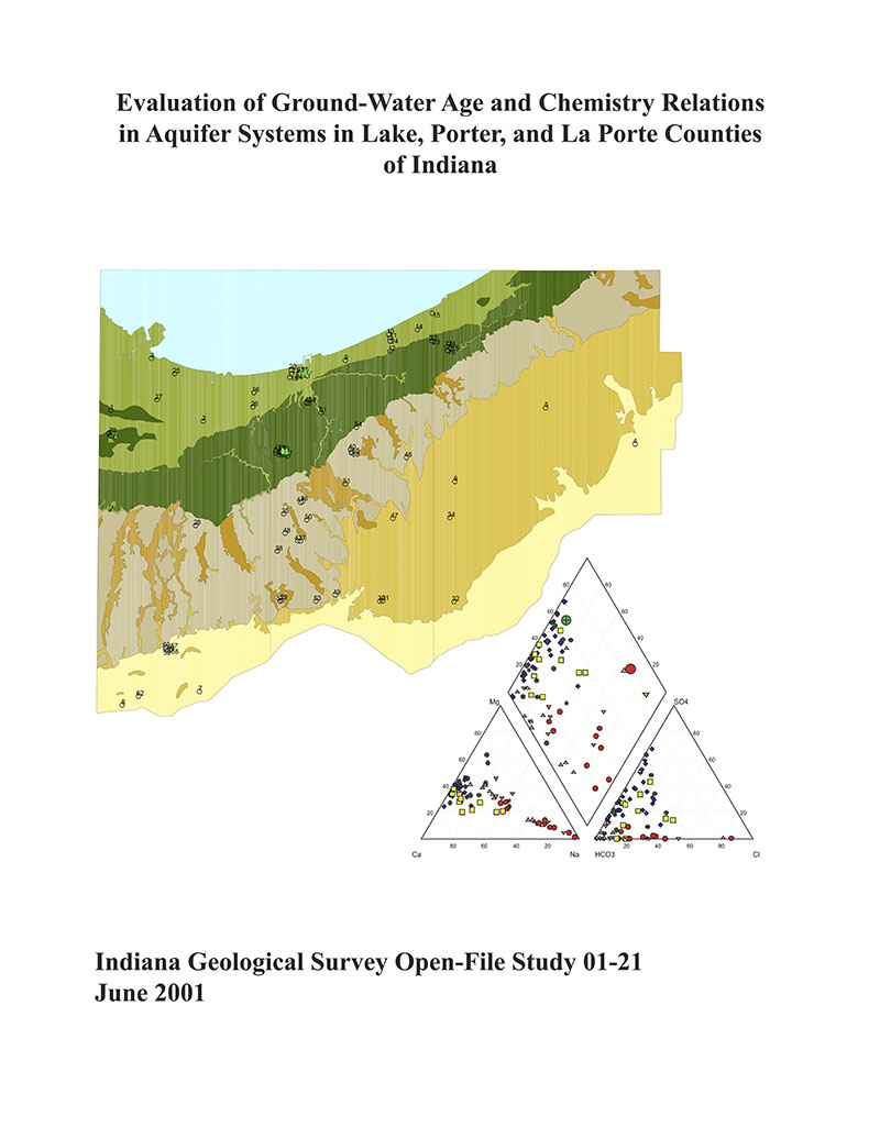
ABSTRACT: This project to evaluate the ground-water age and chemistry relations in aquifer systems in Lake, Porter, and La Porte Counties is, in part, an extension of earlier water quality studies in northwestern Indiana (Hasenmueller and others, 1994; Branam and others, 1997). These projects include baseline surveys of the distribution of tritium, deuterium, and 18O, and major and trace elements in bedrock and unconsolidated postglacial and glacial aquifers, and examine the relation of the water chemistry to the types of the geologic materials incorporated in the aquifers. Aquifers in unconsolidated materials within the southern Lake Michigan rim region lie within sediment packages defined as depositional sequences and are composed of the Quaternary Valparaiso, Wheeler, Lake Border, and Lake Michigan terrain sequences (oldest to youngest). Bedrock units that immediately underlie these deposits include the Wabash Formation (Silurian), Muscatatuck Group (Devonian), the Antrim Shale (Devonian), and the Ellsworth Shale (Devonian and Mississippian). Water samples from the shallower units generally can be characterized as calcium-magnesium-bicarbonate-type. Water samples from both the deeper unconsolidated units and bedrock units are generally characterized as either sodium-bicarbonate or sodium-chloride-type water. Sodium-bicarbonate-chloride water is the type for the majority of water samples from the bedrock units in the northern part of the project area. Water samples from bedrock wells, located in the southwestern part of the project area, have a sodium-calcium-magnesium-bicarbonate chemistry. The concentration of tritium was measured and used in a qualitative manner to date the ground water in the aquifers. A tritium activity greater than 2.0 tritium units (TU) was assumed to indicate post-1952 recharge. Tritium values of <0.8 to 2.0 TU were reported for 40 bedrock- and unconsolidated-aquifer samples. Tritium values of >2.0 to 28.2 TU were reported for the waters from 40 samples and are indicative of varying degrees of post-1952 ground-water recharge. That recharge is notable in samples from the Valparaiso sequence in areas where the clay cap is thin or absent, or the Valparaiso fan complex is present. Most water from the unconsolidated materials appears to be of postglacial origin with delta 18O values ranging from -9.30 to -6.66 parts per thousand and delta 2H values ranging from -61.84 to -51.83 parts per thousand. The delta 18O and delta 2H values are somewhat more negative (lighter) than the current mean average annual values calculated for this area. In contrast, water from bedrock units appears to be partly glacial in origin, having delta 18O values ranging from -19.98 to -8.22 parts per thousand and delta 2H values ranging from -148.15 to -57.47 parts per thousand. Less negative (heavier) delta 18O values are associated with the Wabash Formation in southern Lake County and the Antrim Shale in northern Porter County. These values suggest a mixing and dilution of the bedrock waters with younger water, or perhaps an initial dilution of melting glacial water with late glacial age (warmer) midwestern precipitation. Waters having the more negative (lighter) delta 18O values, ranging from -19.98 to -12.89 parts per thousand, and delta 2H values, ranging from -148.15 to -90.04 parts per thousand, presumably contain much older water that has not been recharged since Pleistocene time. Nontritiated, more highly mineralized (>750 mg/L total dissolved solids) ground water and isotopically lighter ground water characterize confined aquifer systems and suggest a longer residence time. The sensitivity of such aquifers to contamination may be less than that of aquifers that contain tritiated, less mineralized water. Less expensive monitoring techniques can be employed in some cases where the aquifer vulnerability assessment has been based on specific geologic materials in combination with deep water that has not been recharged since Pleistocene time. A Geographic Information System (GIS) format for presentation of the project data was chosen to allow better visualization of the relationship of the ground-water characteristics to the geologic and physiographic units in the three-county area. Database tables of the aquifer properties, geologic data, water chemistry, isotopes, and well location information were compiled. The data set is presented as both ArcView map views and layouts.
Hasenmueller, N. R., Branam, T. D., Bleuer, N. K., Olejnik, J. , Cohen, D. A., O''Neal, M. A. 2001, Evaluation of ground-water age and chemistry relations in aquifer systems in Lake, Porter, and La Porte Counties of Indiana: Indiana Geological Survey Open-File Study 01-21
Notes: Publications in the Indiana Geological Survey Open-File series have been inconsistently named using a variety of series titles including "Open-File Report," "Open-File Map," and "Open-File Study." Prior to 1994, a publication in this series was generally referred to as an "Open-File Report" (but not always). To help reduce confusion created by these inconsistencies, the IGS now refers to every publication in the Open-File series as an "Open-File Study." To be entirely correct in writing a bibliographic reference for a publication, one should use the series name and number that appears on the publication itself.
You may also like:
Keywords: environmental geology, aquifer, chemistry, groundwater, date, age, dating, tritium, GIS, oxygen isotope
Can't find what you're looking for? Feel free to contact us directly:
Indiana Geological and Water Survey
1001 E. 10th St.
Bloomington, IN 47405
812-855-7636 (phone)
812-855-2862 (fax)
IGWSinfo@indiana.edu
IGS Return Policy
- Original sales receipt required.
- Returns accepted within 30 days of purchase date.
- Refund will be issued by the same method of payment as purchased.
- Products must be returned in the same new condition as purchased.
- Refunds on custom orders and digital products are NOT allowed.
- Customers are responsible for paying shipping costs to return products.
Updated 8/19/2020


