

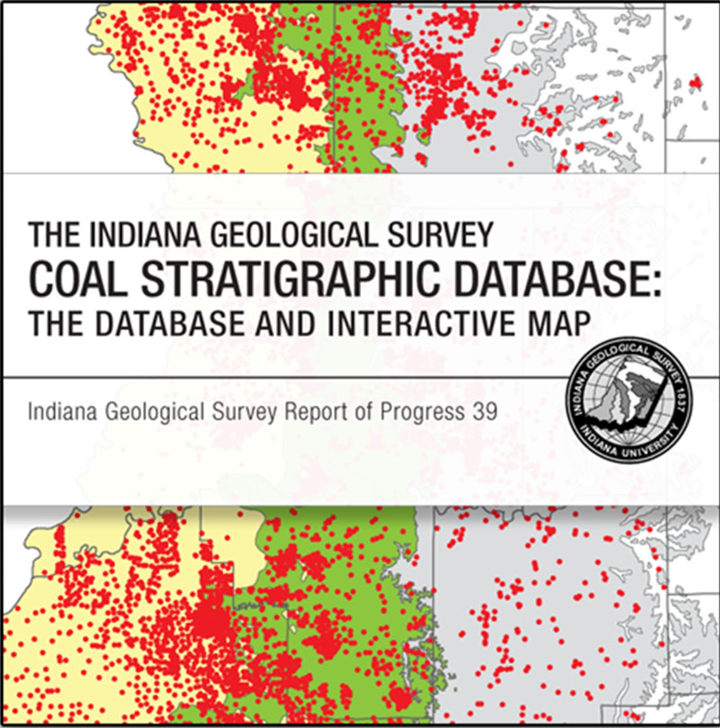
Since 1980, the Indiana Geological Survey has collected coal stratigraphic data in accordance with the National Coal Resources Data System. This cooperative project with the U.S. Geological Survey generates, updates, and maintains coal resource information, including coal location, thickness, depth, stratigraphic position, and surrounding rock data. The Indiana Geological Survey’s Coal Stratigraphic Database provides location and stratigraphic information for 13,722 public point-source coal data in southwestern Indiana. The Indiana Geological Survey’s Coal Stratigraphic Database 2011 interactive application is a visual presentation of the database. It allows users to interactively search, explore, and compare coal stratigraphic data. These data are important for regional coal resource evaluation and can be used by the public, industry, and state and federal governments.
Drobniak, A., and Mastalerz, M. 2012, The Indiana Geological Survey Coal Stratigraphic Database--the database and interactive map: Indiana Geological Survey Report of Progress 39, 23 p., 4 figs., 2 app.
You may also like:


Keywords: coal, database, energy resources, stratigraphy, NCRDS
Can't find what you're looking for? Feel free to contact us directly:
Indiana Geological and Water Survey
1001 E. 10th St.
Bloomington, IN 47405
812-855-7636 (phone)
812-855-2862 (fax)
IGWSinfo@indiana.edu
IGS Return Policy
- Original sales receipt required.
- Returns accepted within 30 days of purchase date.
- Refund will be issued by the same method of payment as purchased.
- Products must be returned in the same new condition as purchased.
- Refunds on custom orders and digital products are NOT allowed.
- Customers are responsible for paying shipping costs to return products.
Updated 8/19/2020