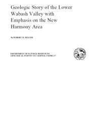
The lower Wabash Valley---215 miles as the river flows from Terre Haute, Ind., to its meeting with the Ohio Valley; 3 to 12 miles across from bedrock wall to bedrock wall; as much as 150 feet from modem alluvial plain to ancient bedrock floor; conduit for 6 1/3 cubic miles of water each year by both gentle current and angry torrent; drainer of 33,000 square miles of basin; reservoir for 750 billion gallons of ground water within the alluvial fill at any given moment; storehouse of 18 cubic miles of sediment, some in active transit but much more waiting thousands of years between legs of its fitful journey to the sea.
Shaver, R. H., 1979, Geologic story of the lower Wabash Valley with emphasis on the New Harmony area: Indiana Geological Survey Occasional Paper 27, 14 p., 6 figs.
You may also like:
Keywords: general interest, Wabash
Can't find what you're looking for? Feel free to contact us directly:
Indiana Geological and Water Survey
1001 E. 10th St.
Bloomington, IN 47405
812-855-7636 (phone)
812-855-2862 (fax)
IGWSinfo@indiana.edu
IGS Return Policy
- Original sales receipt required.
- Returns accepted within 30 days of purchase date.
- Refund will be issued by the same method of payment as purchased.
- Products must be returned in the same new condition as purchased.
- Refunds on custom orders and digital products are NOT allowed.
- Customers are responsible for paying shipping costs to return products.
Updated 8/19/2020


