

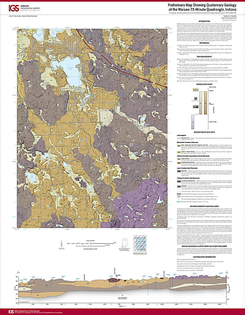
The Warsaw map area, situated in central Kosciusko County, Indiana, is part of a locale that is defined by the retreat of the Huron-Erie Lobe from the classic interlobate region that developed between the Lake Michigan, Saginaw, and Huron-Erie Lobes (Chamberlin, 1883; Leverett and Taylor, 1915). Its glacial history and resulting landscape are complex. The landscape is high relief, collapsed, and commonly chaotic. It is characterized by loam till and large outwash deposits. The landscape is made more dramatic by lakes, marshes, and wetlands (former ice blocks) and collapsed tunnel valley segments that traverse the terrain. The chaotic nature of the landscape lends itself to a complex mixing of sediments, which create a highly variable stratigraphy, both vertically and laterally
Karaffa, M. D., 2015, Preliminary map showing Quaternary geology of the Warsaw 7.5-minute quadrangle, Indiana: Indiana Geological Survey Open-File Study 15-04, scale 1:24,000.
You may also like:
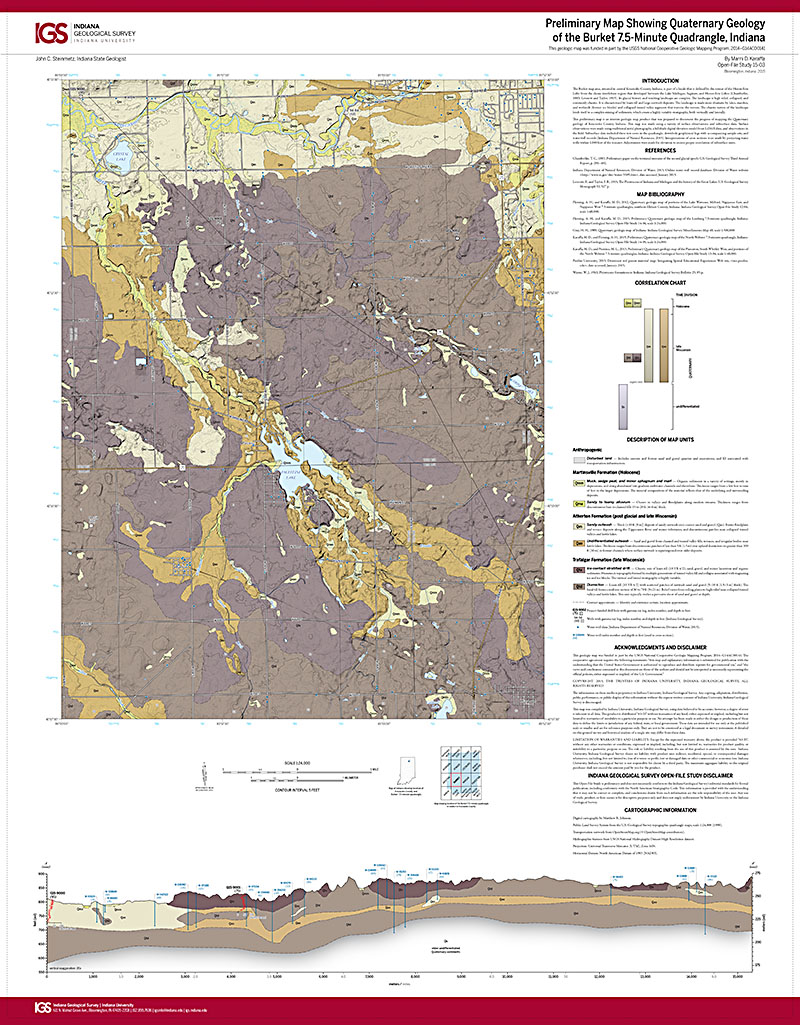
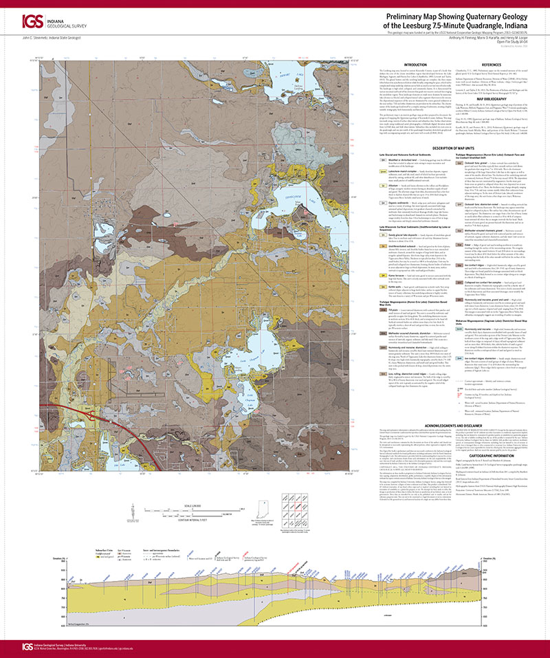
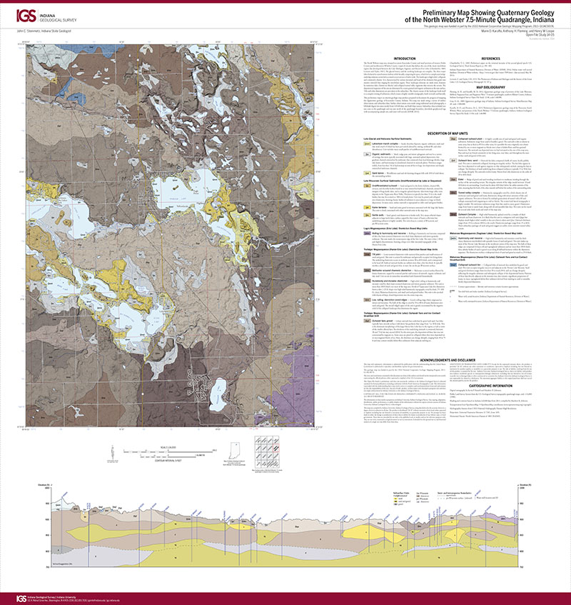
Keywords: map, Quaternary, Kosciusko County, Lake Michigan Lobe, Saginaw Lobe, Huron-Erie Lobe, glacial deposits
Can't find what you're looking for? Feel free to contact us directly:
Indiana Geological and Water Survey
1001 E. 10th St.
Bloomington, IN 47405
812-855-7636 (phone)
812-855-2862 (fax)
IGWSinfo@indiana.edu
IGS Return Policy
- Original sales receipt required.
- Returns accepted within 30 days of purchase date.
- Refund will be issued by the same method of payment as purchased.
- Products must be returned in the same new condition as purchased.
- Refunds on custom orders and digital products are NOT allowed.
- Customers are responsible for paying shipping costs to return products.
Updated 8/19/2020