

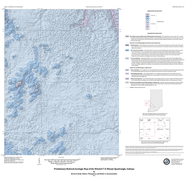
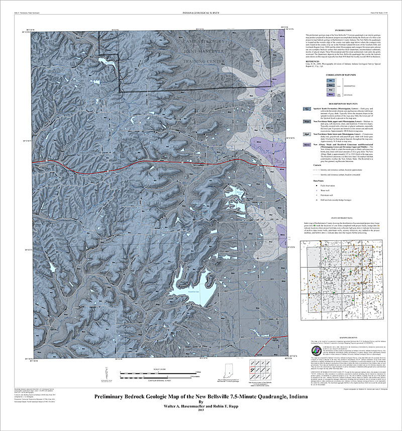
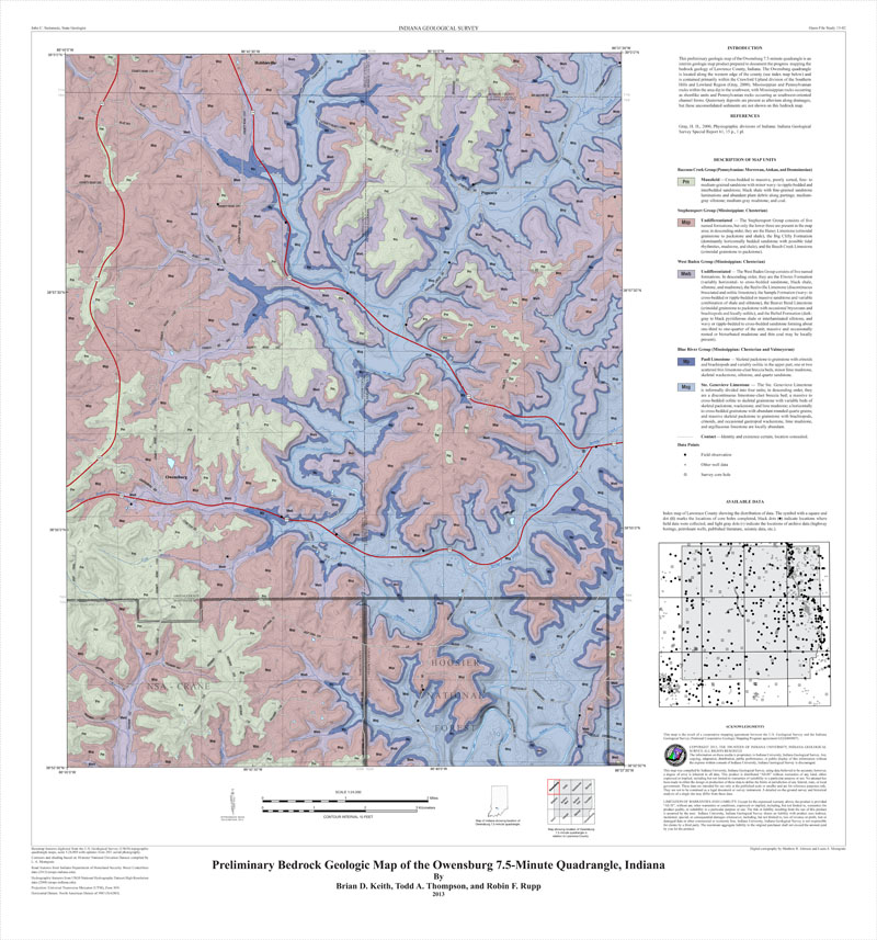
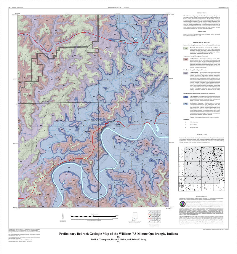
This work map shows the bedrock geology of the Mitchell 7.5-minute quadrangle at a scale of 1:24,000. The map consists of computer-generated outcrop and subcrop patterns of bedrock units. The map presents an interpretation of available public-domain geologic information useful to planners, educators, developers, and others interested in evaluating geologic conditions in the Mitchell area.
Keith, B. , Thompson, T. A., Hasenmueller, W. A. 2011, Preliminary bedrock geologic map of the Mitchell 7.5-minute quadrangle, Indiana: Indiana Geological Survey Open-File Study 11-03
You may also like:
Keywords: bedrock map, geologic map, STATEMAP
Can't find what you're looking for? Feel free to contact us directly:
Indiana Geological and Water Survey
1001 E. 10th St.
Bloomington, IN 47405
812-855-7636 (phone)
812-855-2862 (fax)
IGWSinfo@indiana.edu
IGS Return Policy
- Original sales receipt required.
- Returns accepted within 30 days of purchase date.
- Refund will be issued by the same method of payment as purchased.
- Products must be returned in the same new condition as purchased.
- Refunds on custom orders and digital products are NOT allowed.
- Customers are responsible for paying shipping costs to return products.
Updated 8/19/2020