

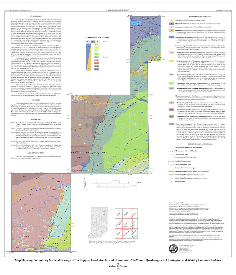
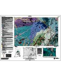
Map showing preliminary surficial geology of the Bippus, Laud, Arcola, and Churubusco 7.5-minute quadrangles in Huntington and Whitley Counties shows the distribution of near-surface unconsolidated sediments classified according to lithology and geomorphology at a scale of 1:63,360. The sediments are subdivided into 14 different map units. Moraines and meltwater channels are the dominant geomorphic features depicted. The limits of several different glacial advances are also shown. The interpretation is based on public-domain geologic information and 17 new 25-foot sediment cores.
Prentice, M. L. 2011, Map showing preliminary surficial geology of the Bippus, Laud, Arcola and Churubusco 7.5-minute quadrangles in Huntington and Whitley Counties, Indiana: Indiana Geological Survey Open-File Study 10-04
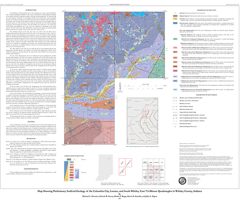
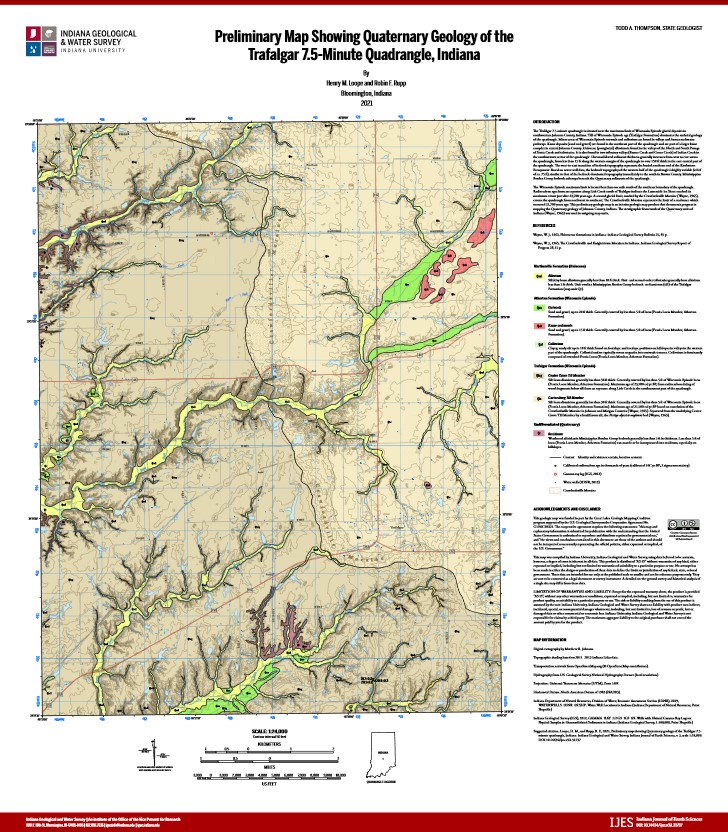
You may also like:
Keywords: surficial geology, glacial geology, moraines, soils, glaciers
Can't find what you're looking for? Feel free to contact us directly:
Indiana Geological and Water Survey
1001 E. 10th St.
Bloomington, IN 47405
812-855-7636 (phone)
812-855-2862 (fax)
IGWSinfo@indiana.edu
IGS Return Policy
- Original sales receipt required.
- Returns accepted within 30 days of purchase date.
- Refund will be issued by the same method of payment as purchased.
- Products must be returned in the same new condition as purchased.
- Refunds on custom orders and digital products are NOT allowed.
- Customers are responsible for paying shipping costs to return products.
Updated 8/19/2020