

| Not available for purchase | |
| Format(s) | Not Available |
|---|---|
MS Access database based on a 1999 version of the Indiana Department of Natural Resources water-well record database. Includes standardized lithologic terms, verified well locations, querying tools, and database editing/updating capability.
Database-GIS interface
The iLITH Database Connection extension for ArcView 3.2 provides easy, on-the-fly SQL connection to the iLITH database.
Graphic tools
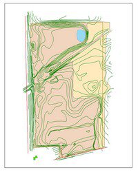
Extensions for plotting, analysis, and file export of subsurface well or borehole data in ArcView 3.x. The Stratigraphic Column Layout extension creates 2-D projected columns and the 3D CoreBuilder extension creates 3-D cores in 3D Analyst.
User guides and documentation
Separate Portable Document Files (PDF format) for each extension and the iLITH database describe installation and use of the database and utilities. Detailed information about glacial geology studies at the Indiana Geological Survey, the purpose for the creation of this product, and a data dictionary are provided in a separate report.
Digital elevation data
The National Elevation Dataset 30-meter digital elevation model of Indiana and adjacent areas is provided on two CD-ROMs.
The USGS National Elevation Dataset (NED) has been developed by merging the highest-resolution, best-quality elevation data available across the United States into a seamless raster format. NED is the result of the maturation of the USGS effort to provide 1:24,000-scale Digital Elevation Model (DEM) data for the conterminous US. More than 200 7.5-minute areas contain corrupt data. The Indiana Geological Survey is working toward replacing those data and will provide a revised DEM dataset at a future date.
Format: ArcGrid
Cell Size: 30 Meters
Map Projection: Geographic
Datum: NAD 83
Vertical Datum: NAVD 88
Software requirements
Microsoft Access 2000: for iLITH database.
ESRI ArcView 3.2: for iLITH Database Connection, Stratigraphic Column Layout, and 3D CoreBuilder.
Database Access Extension 2.0: for iLITH Database Connection.
ArcView 3D Analyst : for 3D CoreBuilder.
ArcView Spatial Analyst , 3D Analyst extensions, or other software that can import USGS GRID data: for National Elevation Dataset DEM.
Glacial Terrain Explorer is a package that includes land surface elevation data and subsurface lithologic data, and tools to enhance visualization of those data in ArcView 3.x. The product is designed for users who are proficient in the use of Microsoft Access 2000 and ArcView 3.x. This product is intended for geoscientists and educators engaged in subsurface geologic and hydrogeologic investigations.
The glacial geology group of the Indiana Geological Survey developed the iLITH database in cooperation with the Indiana Department of Natural Resources, Division of Water. This standardized water-well record database is designed to provide ready assessment of lithologic variation, lithologic trends, and 2D and 3D graphic depiction of that information.
Access to the complete and current Indiana water-well record database is available from the Department of Natural Resources, Division of Water.
The 3 CD-ROM set includes:
iLITH—the Indiana lithologic database
MS Access database based on a 1999 version of the Indiana Department of Natural Resources water-well record database. Includes standardized lithologic terms, verified well locations, querying tools, and database editing/updating capability.
Database-GIS interface
The iLITH Database Connection extension for ArcView 3.2 provides easy, on-the-fly SQL connection to the iLITH database.
Graphic tools
Extensions for plotting, analysis, and file export of subsurface well or borehole data in ArcView 3.x. The Stratigraphic Column Layout extension creates 2-D projected columns and the 3D CoreBuilder extension creates 3-D cores in 3D Analyst.
User guides and documentation
Separate Portable Document Files (PDF format) for each extension and the iLITH database describe installation and use of the database and utilities. Detailed information about glacial geology studies at the Indiana Geological Survey, the purpose for the creation of this product, and a data dictionary are provided in a separate report.
Digital elevation data
The National Elevation Dataset 30-meter digital elevation model of Indiana and adjacent areas is provided on two CD-ROMs.
The USGS National Elevation Dataset (NED) has been developed by merging the highest-resolution, best-quality elevation data available across the United States into a seamless raster format. NED is the result of the maturation of the USGS effort to provide 1:24,000-scale Digital Elevation Model (DEM) data for the conterminous US. More than 200 7.5-minute areas contain corrupt data. The Indiana Geological Survey is working toward replacing those data and will provide a revised DEM dataset at a future date.
Format: ArcGrid
Cell Size: 30 Meters
Map Projection: Geographic
Datum: NAD 83
Vertical Datum: NAVD 88
Software requirements
Microsoft Access 2000: for iLITH database.
ESRI ArcView 3.2: for iLITH Database Connection, Stratigraphic Column Layout, and 3D CoreBuilder.
Database Access Extension 2.0: for iLITH Database Connection.
ArcView 3D Analyst : for 3D CoreBuilder.
ArcView Spatial Analyst , 3D Analyst extensions, or other software that can import USGS GRID data: for National Elevation Dataset DEM.
Brown, S. E., Bleuer, N. K., O''Neal, M. A., Olejnik, J. , Rupp, R. F. 2021, Glacial terrain explorer: Indiana Geological Survey Open-File Study 00-08
Notes: Publications in the Indiana Geological Survey Open-File series have been inconsistently named using a variety of series titles including "Open-File Report," "Open-File Map," and "Open-File Study." Prior to 1994, a publication in this series was generally referred to as an "Open-File Report" (but not always). To help reduce confusion created by these inconsistencies, the IGS now refers to every publication in the Open-File series as an "Open-File Study." To be entirely correct in writing a bibliographic reference for a publication, one should use the series name and number that appears on the publication itself.
You may also like:


Keywords: database, gis, water well, stratigraphic column, ESRI ArcView, DEM, NED, digital elevation model, glacial geology, MS Access, iLith
This item is no longer available. Please contact the Indiana Geological and Water Survey Publication Sales Office for more information. Many IGWS publications are available through local libraries.
Publication Sales Office
Indiana Geological Survey
1001 E. 10th St.
Bloomington, IN 47405
(812) 855-7636 office phone
(812) 855-2862 office fax
IGSINFO@indiana.edu
