

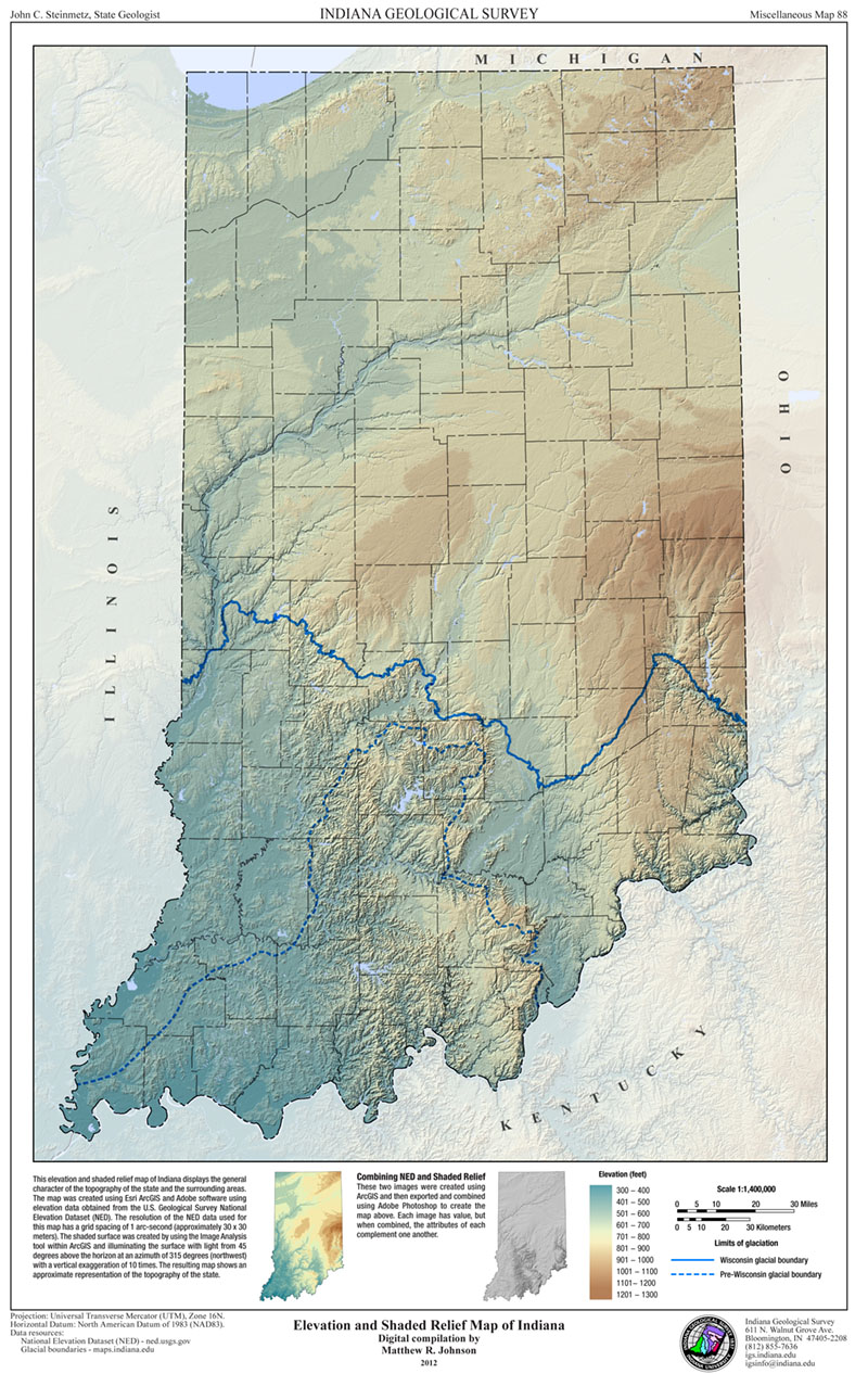
This elevation and shaded relief map of Indiana displays the general character of the topography of the state and the surrounding areas. This map uses a combination of hill-shading effects and elevation data to provide an easy way to visualize the terrain and ground elevation across Indiana. 11” x 17”
Johnson, M. R. 2012, Elevation and shaded relief map of Indiana: Indiana Geological Survey Miscellaneous Map 88
Notes: Size 11" x 17"
You may also like:


Keywords: topography, map, elevation, shaded relief, relief
Can't find what you're looking for? Feel free to contact us directly:
Indiana Geological and Water Survey
1001 E. 10th St.
Bloomington, IN 47405
812-855-7636 (phone)
812-855-2862 (fax)
IGWSinfo@indiana.edu
IGS Return Policy
- Original sales receipt required.
- Returns accepted within 30 days of purchase date.
- Refund will be issued by the same method of payment as purchased.
- Products must be returned in the same new condition as purchased.
- Refunds on custom orders and digital products are NOT allowed.
- Customers are responsible for paying shipping costs to return products.
Updated 8/19/2020