

The IGWS bookstore has moved.
Item Number:
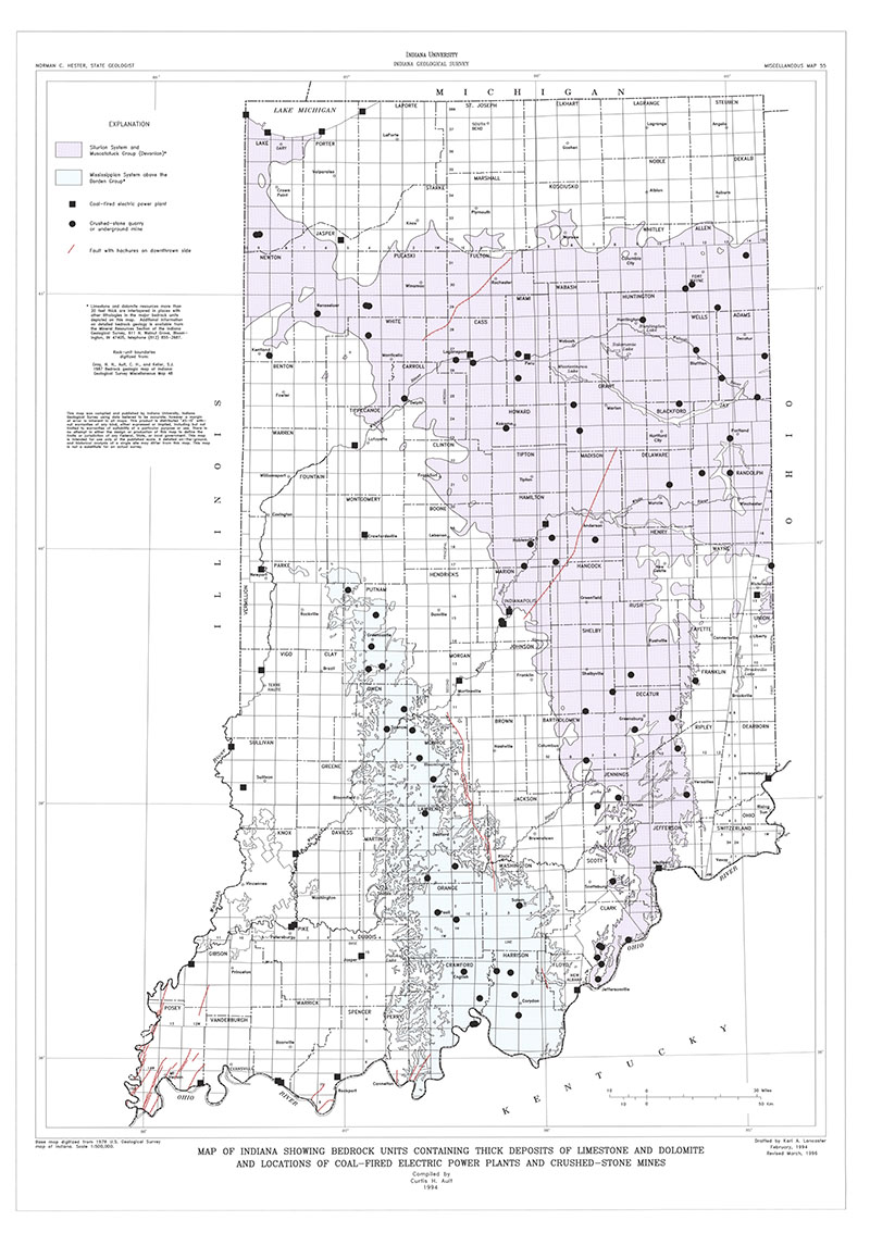
MM55
Map Scale:
1:500,000
Ault, C. H., 1993, Map of Indiana showing bedrock units containing thick deposits of limestone and dolomite and locations of coal-fired electric power plants and crushed-stone mines: Indiana Geological Survey Miscellaneous Map 55, scale 1:500,000.
You may also like:
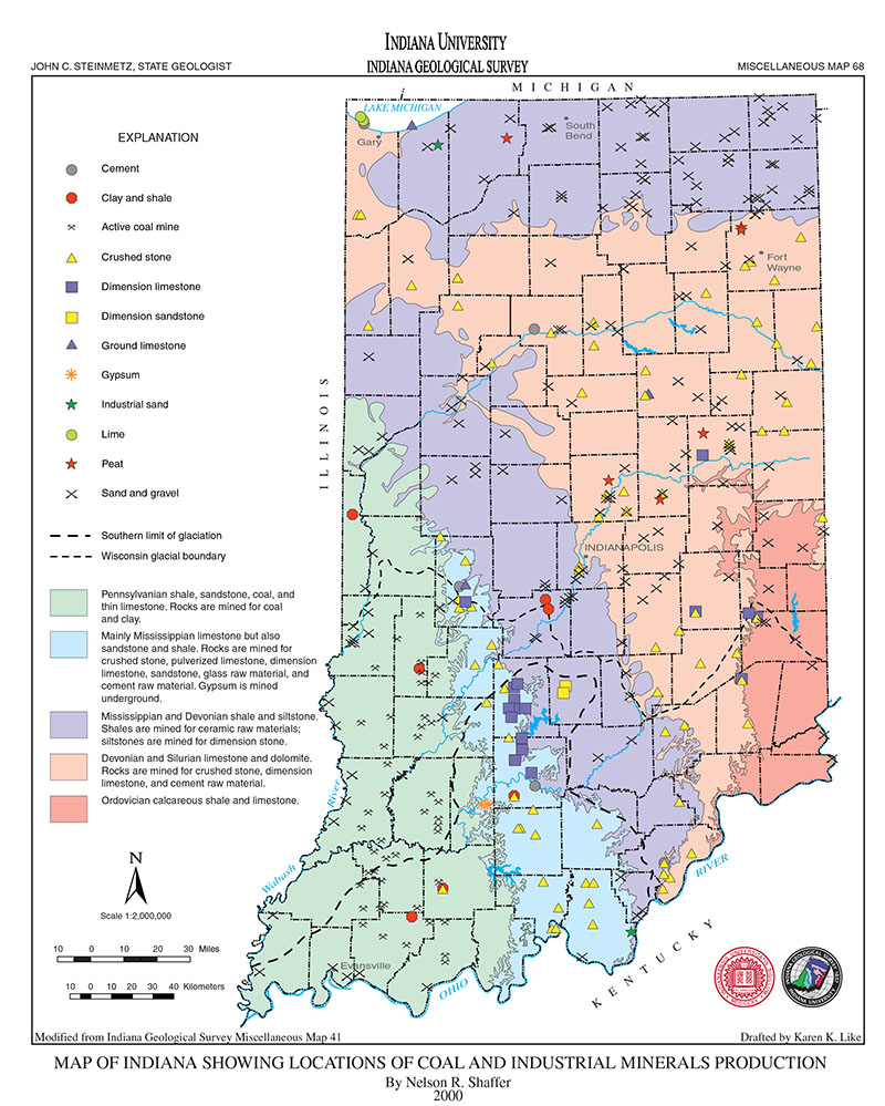
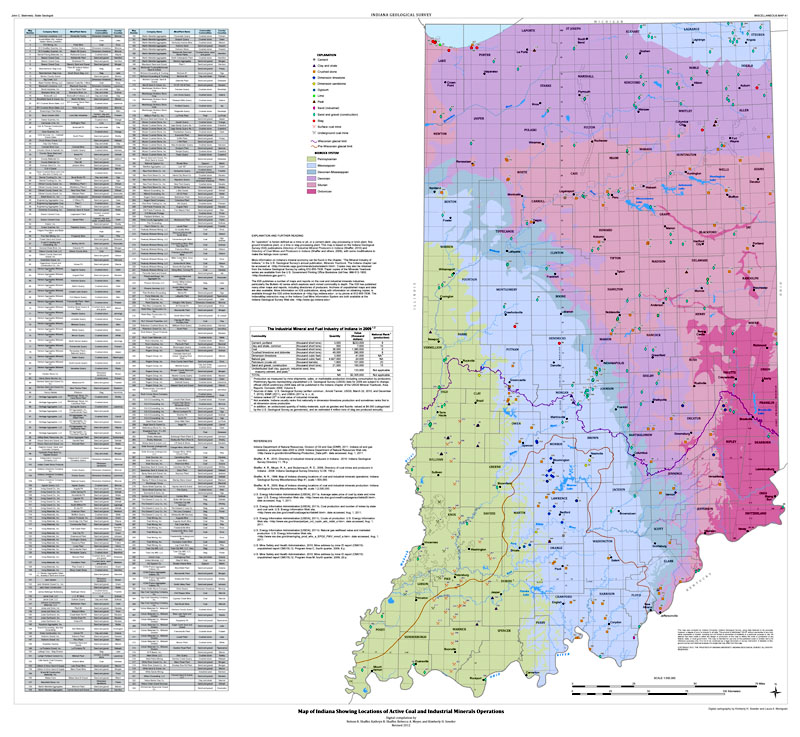


Keywords: bedrock, map, limestone, dolomite, coal, industrial minerals, energy resources
Can't find what you're looking for? Feel free to contact us directly:
Indiana Geological and Water Survey
1001 E. 10th St.
Bloomington, IN 47405
812-855-7636 (phone)
812-855-2862 (fax)
IGWSinfo@indiana.edu
IGS Return Policy
- Original sales receipt required.
- Returns accepted within 30 days of purchase date.
- Refund will be issued by the same method of payment as purchased.
- Products must be returned in the same new condition as purchased.
- Refunds on custom orders and digital products are NOT allowed.
- Customers are responsible for paying shipping costs to return products.
Updated 8/19/2020