
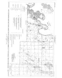
Tanner, G. F., Stellavato, J. N., and Mackey, J. C., 1981, Map of southwestern Gibson County, Indiana showing structure on Springfield Coal Member (V) of the Petersburg Formation (Pennsylvanian): Indiana Geological Survey Miscellaneous Map 32, scale 1:31,680.
You may also like:
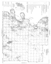
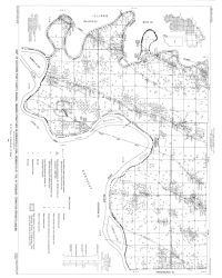


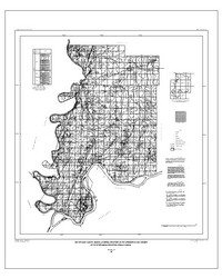


Keywords: Springfield Coal Member, Petersburg Formation, Pennsylvanian, map, structure, coal, energy resources, Carbondale Group
Can't find what you're looking for? Feel free to contact us directly:
Indiana Geological and Water Survey
1001 E. 10th St.
Bloomington, IN 47405
812-855-7636 (phone)
812-855-2862 (fax)
IGWSinfo@indiana.edu
IGS Return Policy
- Original sales receipt required.
- Returns accepted within 30 days of purchase date.
- Refund will be issued by the same method of payment as purchased.
- Products must be returned in the same new condition as purchased.
- Refunds on custom orders and digital products are NOT allowed.
- Customers are responsible for paying shipping costs to return products.
Updated 8/19/2020
