

The IGWS bookstore has moved.
Item Number:
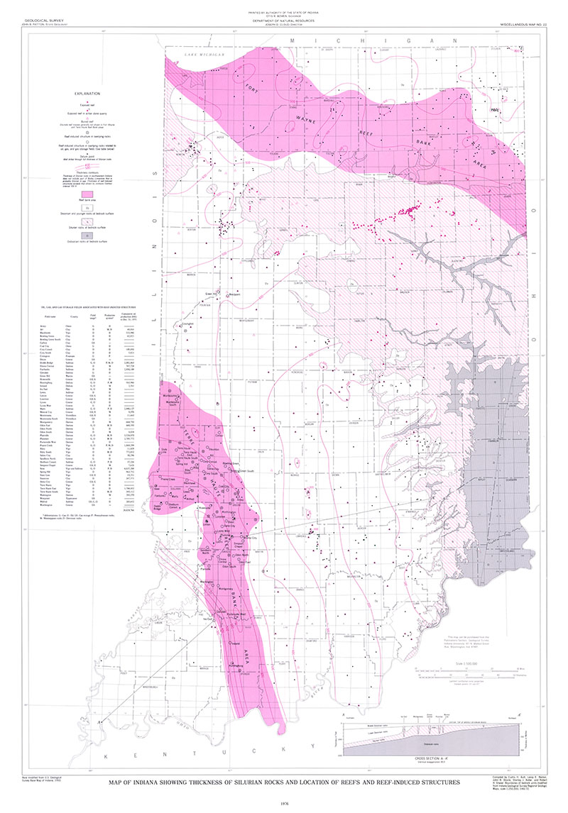
MM22
Map Scale:
1:500,000
Ault, C. H., Becker, L. E., Droste, J. B., Keller, S. J., and Shaver, R. H., 1976, Map of Indiana showing thickness of Silurian rocks and location of reefs and reef-induced structures: Indiana Geological Survey Miscellaneous Map 22, scale 1:500,000.
You may also like:
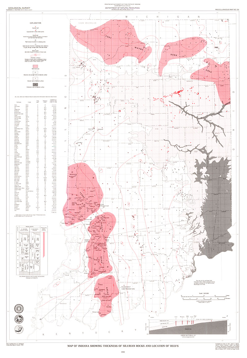


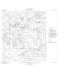
Keywords: Silurian, reef, map, thickness
Can't find what you're looking for? Feel free to contact us directly:
Indiana Geological and Water Survey
1001 E. 10th St.
Bloomington, IN 47405
812-855-7636 (phone)
812-855-2862 (fax)
IGWSinfo@indiana.edu
IGS Return Policy
- Original sales receipt required.
- Returns accepted within 30 days of purchase date.
- Refund will be issued by the same method of payment as purchased.
- Products must be returned in the same new condition as purchased.
- Refunds on custom orders and digital products are NOT allowed.
- Customers are responsible for paying shipping costs to return products.
Updated 8/19/2020