

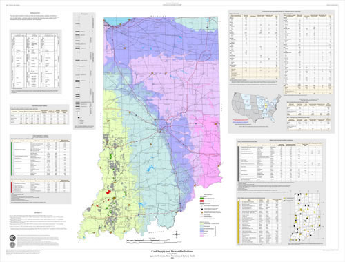
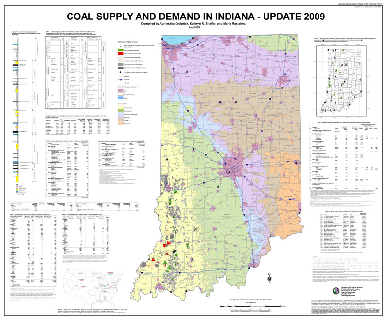
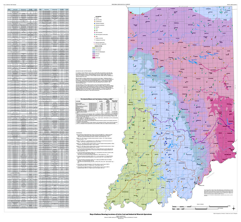
This map depicts locations of active coal mines and mined-out areas, as well as the locations of coal-fired power plants in Indiana. In addition, infrastructure important for coal supply and utilization such as roads, railways, and water bodies are included. Accompanying tables provide current information about coal resources, production, and consumption. This map is the updated version of MM 72 and OFS 09-05.
Drobniak, A. , Shaffer, K. R., Meyer, R. , Mastalerz, M. 2013, Coal supply and demand in Indiana--2012 update: Indiana Geological Survey Open-File Study 12-07, 3 fig.
Notes: Poster is 46 x 42 inches
You may also like:

Keywords: coal, electric power plants, coal mines, infrastructure, coal resources, coal-fired power plants, active coal mines, coal supply
Can't find what you're looking for? Feel free to contact us directly:
Indiana Geological and Water Survey
1001 E. 10th St.
Bloomington, IN 47405
812-855-7636 (phone)
812-855-2862 (fax)
IGWSinfo@indiana.edu
IGS Return Policy
- Original sales receipt required.
- Returns accepted within 30 days of purchase date.
- Refund will be issued by the same method of payment as purchased.
- Products must be returned in the same new condition as purchased.
- Refunds on custom orders and digital products are NOT allowed.
- Customers are responsible for paying shipping costs to return products.
Updated 8/19/2020
