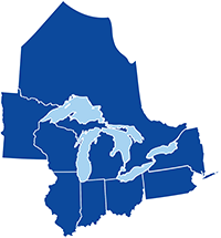
producing urgently needed, detailed, three-dimensional surficial materials maps of the Great Lakes states

Supporting Statements "The insurance industry is just now coming to realize the importance of geologic information for assessing their exposure to risk."—T. Elliot, Insurance Underwriter, State Farm Insurance
"For the National Watershed Assessment Project, geology is the major missing data layer."—E. J. Fellows, U.S. Environmental Protection Agency "There has been a high rate of failure of restoring wetlands because sites have been selected that do not properly link the site hydrology to its geologic setting. In response to this, the Illinois Nature Conservancy has identified several areas that would be ideal to accomplish their restoration goals and insist that sites be in 'geologically appropriate' areas. Working with the Geological Survey in the early stages is important, and should be seen as an essential and primary step in developing successful restoration projects.—T. H. Tear, Director of Conservation Science, The Nature Conservancy of Illinois "Delineation of 5-year travel time [of ground water] requires the use of geology to see where the regulations need to be applied."—R. Duncan, Indiana Department of Environmental Management "The original attempt at siting a low-level nuclear waste repository failed because geology did not play a big enough role in the process"—S. Esling, Associate Professor of Geology, Southern Illinois University "We run centuries old disposal methods of septic systems and manure spreading on much higher densities than ever intended."—B. Grant, Toxicologist, LaGrange County Health Department, Indiana You need to define geology and make it available in digital data bases to serve customers."—T. Bruns, Director of Development Services, Indianapolis Water Co. "Regional geologic mapping is critical to integrated management of aquifers."—M. Johnson, Vice President, Northern Illinois Water Corp. "Accurate geologic mapping is vital to everything we do in that it facilitates responsible decision making during preliminary phases and enables us to put site specific conditions into the appropriate regional context."—Herbert B. Eagon, Jr., President, Eagon, & Associates, Inc., Consulting Geologists "Geologic maps have served a tremendous need in helping to identify numerous groundwater contamination problems involving volatile organic chemicals. These findings allowed our department to get homeowners off of private water wells that were contaminated and to decrease the density of development on private sewage systems in vulnerable geologic areas. As useful as this information has been, we are in great need of updating these maps to a greater depth and to be able to incorporate these more sophisticated features into our local GIS mapping system to serve planning and developer needs."—J. Maichle Bacon, Public Health Administrator, Winnebago County Health Department "Currently, we are doing research to locate suitable sites for ethanol plants. Geologic maps have been a tremendous help in decision making for our developments, we need to locate areas with adequate water supply and this department has saved us an enormous amount of time and money with their resources."—Bud Hamer, Hamer Developers and Consultants "We believe that the core function of the Central Great Lakes Geologic Mapping Coalition—to generate this much needed information—is essential to ensure balanced, and continued, growth and development.—Deirdre K. Hirner, Executive Director, Illinois Environmental Regulatory Group |
HomepageGeologic MappingDelivering Information
Users and SupportersCoalition in Action |