

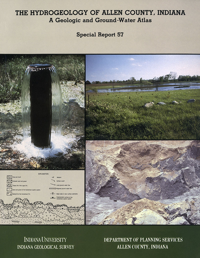
Allen County is in northeastern Indiana, adjacent to the Ohio state line about 33 miles south of the Michigan state line. The county is approximately 671 square miles in size and had a total population of about 300,000 in 1990. The county seat is the City of Fort Wayne, one of the most rapidly growing metropolitan areas in Indiana. Ground water is the principal source of water for more than half of the residents and much of the industry in the county. The City of Fort Wayne is the only areas in the county served by a public water supply derived from surface sources. Population growth is greatest in outlying areas, thus it is likely that the percentage of county residents and businesses served by ground water will grow in the future. Due to the humid climate and abundant precipitation (approximately 35 to 40 inches per year), the growing reliance on ground water in Allen County is unlikely to be threatened by inadequate quantity. Although a few widely scattered locations do exist in the county were groundwater availability is somewhat limited, a far more significant threat is the potential for contamination of productive aquifers by activities or facilities located in areas where the ground water is naturally susceptible to pollution. The high economic, societal, and environmental costs of polluted ground water are well known and far exceed the relatively minimal costs associated with preventing ground-water contamination in the first place. For example, several million dollars have reportedly been spent attempting to clean up soil and ground-water contamination at just one Superfund site in Allen County, whereas the cost of this study is less than $200,000. Growing recognition of these costs, coupled with the highly publicized nature of many ground-water contamination incidents and the identification of a wide variety of potential contaminants and activities that can negatively impact ground-water quality (U.S.E.P.A., 1980; Pye and Kelly, 1984), have led to a heightened awareness of the need to protect ground-water quality on the part of concerned citizens and local officials. This study was initiated at the request of several Allen County agencies in order to provide information needed to understand and protect the ground-water resources into the land-use planning and screening activities. The information contained in this study is presented at too course a scale to be suitable for most site-specific activities but it provides a useful regional perspective for more detailed site investigations.
Fleming, A. H., 1994, The hydrogeology of Allen County, Indiana—a geologic and ground-water atlas: Indiana Geological Survey Special Report 57, 111 p., 10 pls., 17 figs. doi: 10.5967/dyna-cr60
You may also like:
Keywords: hydrogeology, aquifer, glacial, geologic map, groundwater, environmental
Can't find what you're looking for? Feel free to contact us directly:
Indiana Geological and Water Survey
1001 E. 10th St.
Bloomington, IN 47405
812-855-7636 (phone)
812-855-2862 (fax)
IGWSinfo@indiana.edu
IGS Return Policy
- Original sales receipt required.
- Returns accepted within 30 days of purchase date.
- Refund will be issued by the same method of payment as purchased.
- Products must be returned in the same new condition as purchased.
- Refunds on custom orders and digital products are NOT allowed.
- Customers are responsible for paying shipping costs to return products.
Updated 8/19/2020