

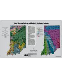
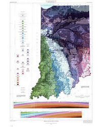
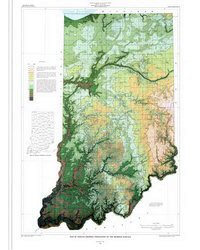
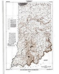
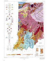
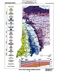
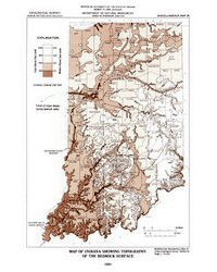
Geologists collect and summarize geologic information on many different types of maps. Two common types are those that show rocks and unconsolidated materials. Maps that show rocks or named rock units are bedrock geology maps, whereas maps of unconsolidated material, such as sand, gravel, mud, and soil, are surficial geology maps. Both maps illustrate and help define the distribution of distinct types of earth materials as projected onto the land surface. Surficial geology maps show unconsolidated materials at the earth's surface, and therefore, do not illustrate the distribution of these deposits below the ground. Bedrock geology maps show rocks and rock units at the surface of the bedrock, which may not be exposed at the earth's surface. In Indiana, bedrock is exposed only in the south-central part of the state and along some major rivers. In the northern half of the state, the bedrock is in places covered by more than 400 feet of glacial till, sand, gravel, and clay.
Thompson, T. A., Sowder, K. 2005, Map showing surficial and bedrock geology of Indiana: Indiana Geological Survey Open-File Study 05-01
You may also like:


Keywords: wall map, geologic map, teachers, map, bedrock, geology, surficial
Can't find what you're looking for? Feel free to contact us directly:
Indiana Geological and Water Survey
1001 E. 10th St.
Bloomington, IN 47405
812-855-7636 (phone)
812-855-2862 (fax)
IGWSinfo@indiana.edu
IGS Return Policy
- Original sales receipt required.
- Returns accepted within 30 days of purchase date.
- Refund will be issued by the same method of payment as purchased.
- Products must be returned in the same new condition as purchased.
- Refunds on custom orders and digital products are NOT allowed.
- Customers are responsible for paying shipping costs to return products.
Updated 8/19/2020