

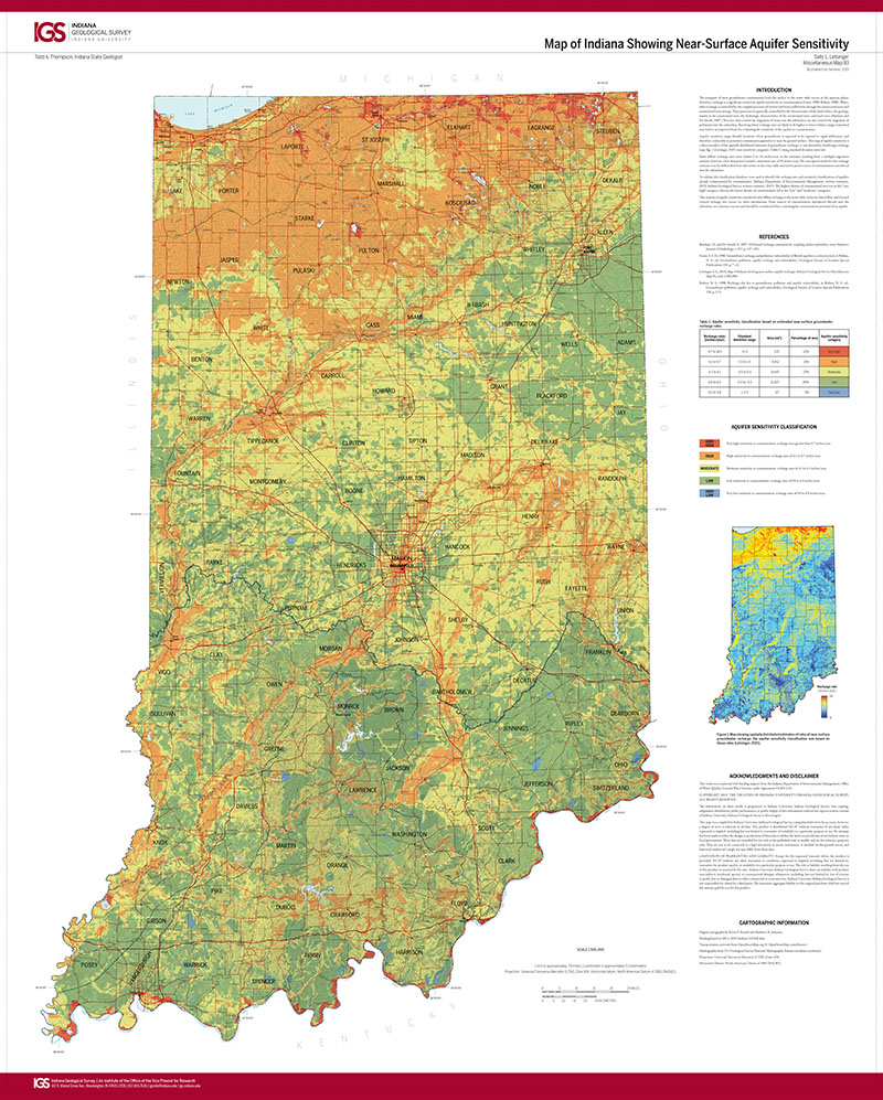
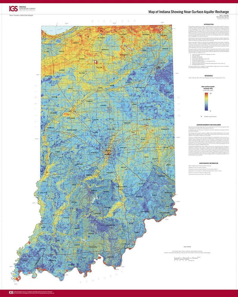
The transport of most groundwater contaminants from the surface to the water table occurs in the aqueous phase; therefore, recharge is a significant control on aquifer sensitivity to contamination (Foster, 1998; Robins, 1998). Watertable recharge is controlled by the coupled processes of vertical soil-water infiltration through the unsaturated zone and unsaturated-zone storage. These processes are generally controlled by the characteristics of the land surface, the geologic matrix in the unsaturated zone, the hydrologic characteristics of the unsaturated zone, and land cover (Batelaan and De Smedt, 2007). Processes that control the migration of water into the subsurface can also control the migration of pollutants into the subsurface. Knowing where recharge rates are likely to be higher or lower within a larger watershed may lead to an improved basis for evaluating the sensitivity of the aquifer to contamination.
Letsinger, S. L., 2015, Map of Indiana showing near-surface aquifer sensitivity: Indiana Geological Survey Miscellaneous Map 93, scale 1:500,000.
You may also like:


Keywords: aquifers, environmental geology, hydrogeology, aquifer sensitivity, recharge
Can't find what you're looking for? Feel free to contact us directly:
Indiana Geological and Water Survey
1001 E. 10th St.
Bloomington, IN 47405
812-855-7636 (phone)
812-855-2862 (fax)
IGWSinfo@indiana.edu
IGS Return Policy
- Original sales receipt required.
- Returns accepted within 30 days of purchase date.
- Refund will be issued by the same method of payment as purchased.
- Products must be returned in the same new condition as purchased.
- Refunds on custom orders and digital products are NOT allowed.
- Customers are responsible for paying shipping costs to return products.
Updated 8/19/2020