

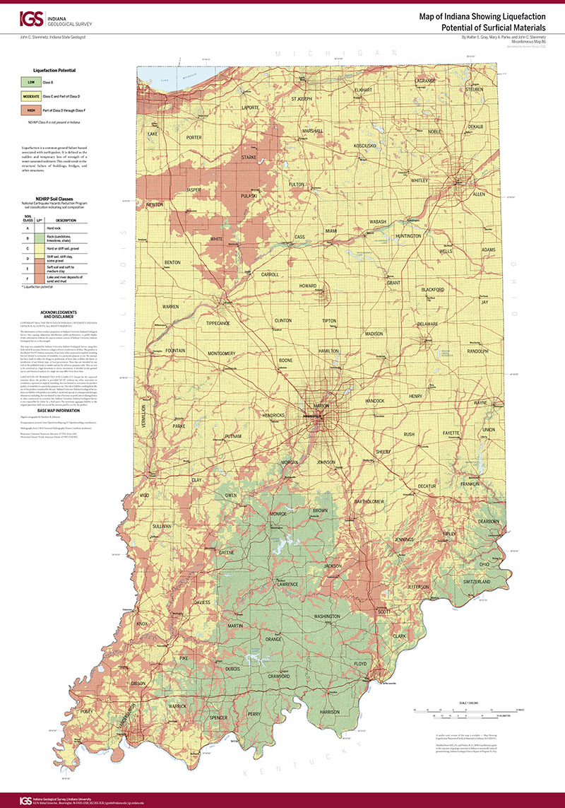
This map was prepared for emergency planners and educators as a simplified guide to the distribution and classification of National Earthquake Hazards Reduction Program (NEHRP) soil types in Indiana. Liquefaction potential is displayed as either low, moderate, or high. County names, hydrological features, and roadways are provided as recognizable reference points. A smaller version of map, IGS MM81 (scale, 1:1,193,061), is also available. 1" = 8 miles 26" x 41"
Gray, W. E., Parke, M., and Steinmetz, J. C. 2012, Map of Indiana showing liquefaction potential of surficial materials: Indiana Geological Survey Miscellaneous Map 86, scale 1:500,000.
You may also like:
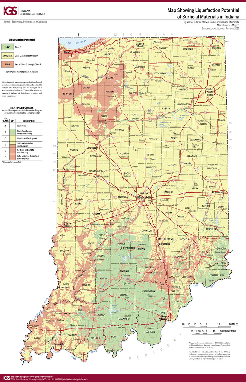
Keywords: liquefaction potential, seismic, earthquake
Can't find what you're looking for? Feel free to contact us directly:
Indiana Geological and Water Survey
1001 E. 10th St.
Bloomington, IN 47405
812-855-7636 (phone)
812-855-2862 (fax)
IGWSinfo@indiana.edu
IGS Return Policy
- Original sales receipt required.
- Returns accepted within 30 days of purchase date.
- Refund will be issued by the same method of payment as purchased.
- Products must be returned in the same new condition as purchased.
- Refunds on custom orders and digital products are NOT allowed.
- Customers are responsible for paying shipping costs to return products.
Updated 8/19/2020