

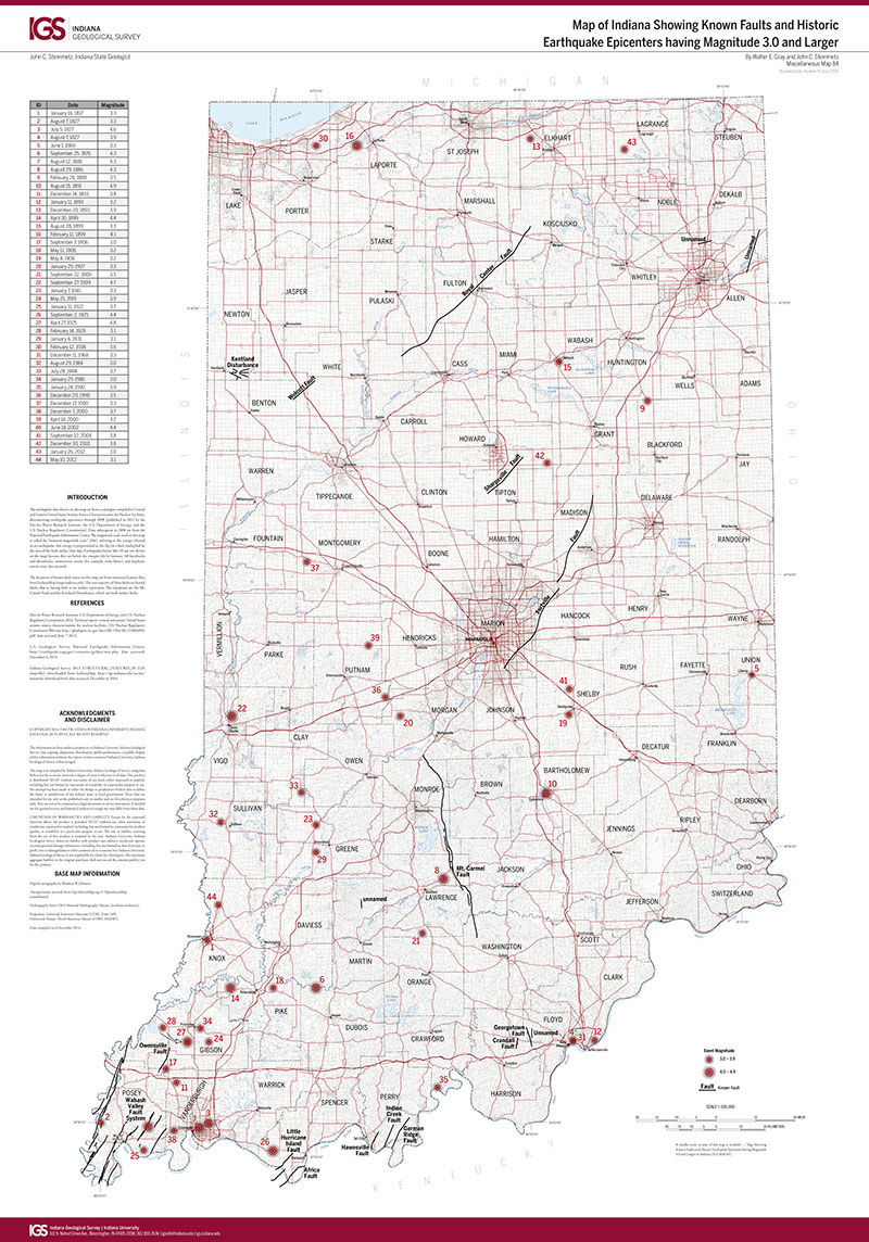
This map displays historic earthquake epicenters occurring in Indiana since 1817 in addition all known faults. Earthquakes magnitudes are reported as moment magnitude. County names, hydrological features, and roadways are provided as recognizable reference points. A smaller version of this map, IGS MM85 (scale, 1:1,193,061, is also available. 1" = 8 miles 26" x 41"
Gray, W. E., and Steinmetz, J. C. 2012, Map of Indiana showing known faults and historic earthquake epicenters having magnitude of 3.0 and larger: Indiana Geological Survey Miscellaneous Map 84, scale 1:500,000.
You may also like:
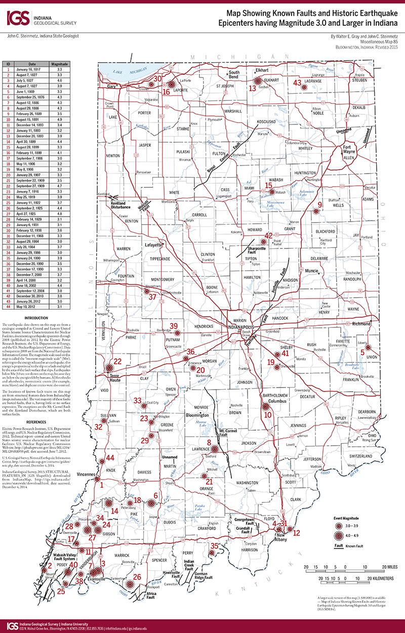
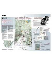

Keywords: epicenter, fault, magnitude, earthquake
Can't find what you're looking for? Feel free to contact us directly:
Indiana Geological and Water Survey
1001 E. 10th St.
Bloomington, IN 47405
812-855-7636 (phone)
812-855-2862 (fax)
IGWSinfo@indiana.edu
IGS Return Policy
- Original sales receipt required.
- Returns accepted within 30 days of purchase date.
- Refund will be issued by the same method of payment as purchased.
- Products must be returned in the same new condition as purchased.
- Refunds on custom orders and digital products are NOT allowed.
- Customers are responsible for paying shipping costs to return products.
Updated 8/19/2020