

| Not available for purchase | |
| Format(s) | Not Available |
|---|---|
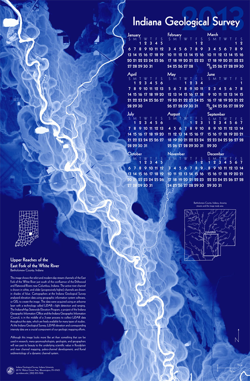
The image on this 21 by 33 inch full-color calendar printed on heavy poster paper shows the relict and modern-day stream channels of the East Fork of the White River just south of the confluence of the Driftwood and Flatwood Rivers near Columbus, Indiana. Cartographers at the Indiana Geological Survey analyzed elevation data using geographic information system software, or GIS, to create the image. The data were acquired using an airborne laser with a technology called LiDAR—light detection and ranging. At the Indiana Geological Survey, LiDAR elevation and corresponding intensity data are a crucial component of our geologic mapping efforts.
2012, Indiana Geological Survey 2013 Calendar: Indiana Geological Survey Calendar 2013
You may also like:

Keywords: LiDAR, GIS, stream, history, calendar
This item is no longer available. Please contact the Indiana Geological and Water Survey Publication Sales Office for more information. Many IGWS publications are available through local libraries.
Publication Sales Office
Indiana Geological Survey
1001 E. 10th St.
Bloomington, IN 47405
(812) 855-7636 office phone
(812) 855-2862 office fax
IGSINFO@indiana.edu