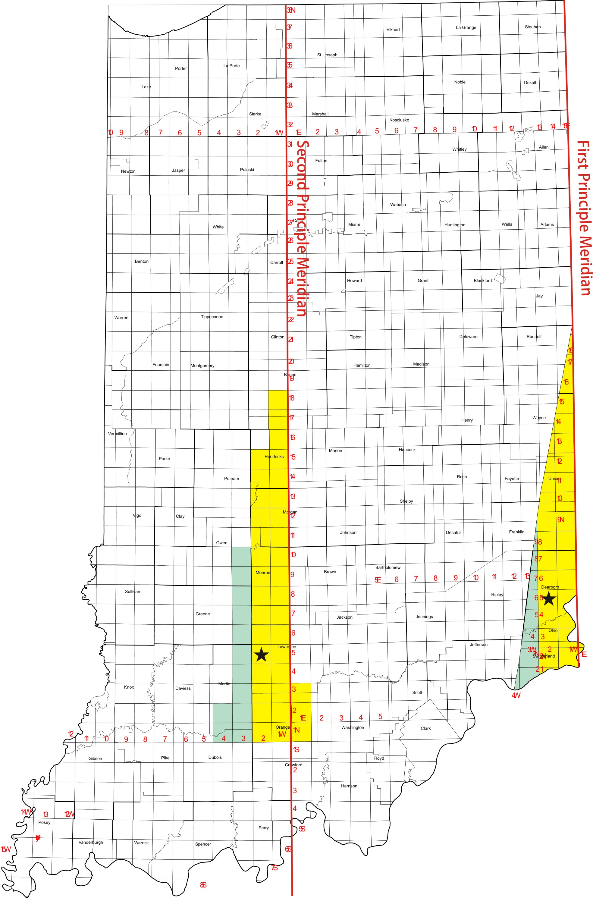
Designates which of two base lines was used in the Congressional Township and Range Survey System to map two respective areas in Indiana.
"First" or "1" refers to the "First Principle Meridian" that served as a base line in the Congressional Township and Range Survey System for measuring a relatively small sliver of land in southeastern Indiana. The First Principle Meridian is located in Ohio.
"Second" or "2" refers to the "Second Principle Meridian" that served as a base line in the Congressional Township and Range Survey System for measuring all of Indiana except a relatively small slice of land in southeastern Indiana which used the First Principle Meridian.
On the map of Indiana below, the easternmost area colored green and yellow contains the townships referenced by the 1st Principle Meridian, which is located in Ohio. Two colors are used just to illustrate a shift in the township numbering sequence that occurs within the easternmost area. The shift is incidental to the position of the 1st Principle Meridian.
The rest of the state is referenced by the 2nd Principle Meridian. One result of using the dual meridians in Indiana is that some township names are used twice. For example, one "T.5N-R.2W." (1st Meridian, indicated by easternmost star) is located in Dearborn County, and another "T.5N-R.2W." (2nd Meridian, the westernmost star) is found in Lawrence County. This "double naming" of townships can be seen on the map where the 2nd Meridian townships that have names matching those in the 1st Meridian are shown in the same color scheme. Other than the overlap with 1st Meridian names, coloring on the western area on the map has no significance.