

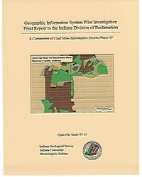
INTRODUCTION: In 1981, the Indiana Geological Survey (IGS) (then the Geological Survey Division of hte Indiana Department of Natural Resources) began a cooperative project with the Indiana Division of Reclamation (DOR) under the Abandoned Mine Lands (AML) program to construct a database containing digital spatial and tabular coal mine data. The purpose of this system was to assist the AML program in reclamation design and site eligibility determination. Since the advent of that initial project, the Indiana Geological Survey (no longer a Division of the DNR, but an Institute of Indiana University) has completed a variety of projects designed to further develop and improve this data system. The relationship has been mutually rewarding, providing AML with a wealth of digital and tabular coal mine data while adding to the Survey's repository of geological information. The most recent contract with AML, Indiana Coal Mine Information System, Phase VI, comprises of these three components: updating outlines of post-1977 surface and underground mines, vectorizing underground mine workings from 16 southwest Indiana counties, and initiating an investigation of the utility and feasibility of GIS for the Title V section of the Division of Reclamation. This report is specifically dedicated to the final component of the contract and thus focuses on the results of the GIS Pilot Investigation. The pilot GIS is referred to as the Indiana Coal Mine Information System (CMIS), because it is designed to compliment (and possibly replace) the previously developed spatial and tabular system of the same name.
Eaton, N. K., Blunck, D. R. 1997, Final report of the geographic information system (GIS) pilot investigation for the Indiana Division of Reclamation: Indiana Geological Survey Open-File Study 97-15, 47 p., 14 fig.
Notes: Publications in the Indiana Geological Survey Open-File series have been inconsistently named using a variety of series titles including "Open-File Report," "Open-File Map," and "Open-File Study." Prior to 1994, a publication in this series was generally referred to as an "Open-File Report" (but not always). To help reduce confusion created by these inconsistencies, the IGS now refers to every publication in the Open-File series as an "Open-File Study." To be entirely correct in writing a bibliographic reference for a publication, one should use the series name and number that appears on the publication itself.
4 appendices.
You may also like:


Keywords: mine, coal, database, GIS
Can't find what you're looking for? Feel free to contact us directly:
Indiana Geological and Water Survey
1001 E. 10th St.
Bloomington, IN 47405
812-855-7636 (phone)
812-855-2862 (fax)
IGWSinfo@indiana.edu
IGS Return Policy
- Original sales receipt required.
- Returns accepted within 30 days of purchase date.
- Refund will be issued by the same method of payment as purchased.
- Products must be returned in the same new condition as purchased.
- Refunds on custom orders and digital products are NOT allowed.
- Customers are responsible for paying shipping costs to return products.
Updated 8/19/2020