

ABSTRACT: This study estimates the availability of coal resources in the Glendale 7.5 Minute Quadrangle, Daviess County, in southwestern Indiana. The total original coal in place, remaining coal after mining, and available coal resources were calculated for four coal beds underlying the study area. In ascending stratigraphic order, the four coal beds which belong to the Raccoon Creek Group of the Pennsylvanian System are Lower Block Coal Member, Upper Block Coal Member, Buffaloville (Minshall) Coal Member of the Brazil Formation, and an unnamed coal of the Staunton Formation herein informally termed the "Holland" coal because of its stratigraphic position relative to the Holland Limestone Member of the Staunton Formation. Other coal beds are present in the quadrangle but are not considered in this report either because there is too little information to accurately calculate resources or the coals are present only locally. Resources were calculated by assigning each coal data point to one of two coal thickness categories, "14-28 inches," or "greater than 28 inches," and to one of two overburden thickness categories, "0-200 feet" or "200-1000 feet." In addition, the coal resource relative to each data point was characterized by four levels of data reliability or confidence. The reliability categories express the relative confidence in finding coal at a particular location based upon distance from a data point. The four categories are: measured (0-0.25 miles from the data point), indicated (0.25-0.75 miles), inferred (0.75-3.0 miles), and hypothetical (3.0-10.0 miles). The four coal beds comprised 492 short tons of total original resources in the study area. Of the 492 million short tons, 7 million short tons have been removed by mining or lost in the mining process, thus leaving 485 million short tons of remaining resources. Because of land-use and technological restrictions, 256 million short tons (52% of the original resources or 53% of the remaining resources) are available for mining the area
Conolly, C. L., Cetin, H. 1996, Coal availability study in Indiana: Glendale 7.5 minute quadrangle: Indiana Geological Survey Open-File Study 96-05, 49 p., 27 fig.
Notes: Publications in the Indiana Geological Survey Open-File series have been inconsistently named using a variety of series titles including "Open-File Report," "Open-File Map," and "Open-File Study." Prior to 1994, a publication in this series was generally referred to as an "Open-File Report" (but not always). To help reduce confusion created by these inconsistencies, the IGS now refers to every publication in the Open-File series as an "Open-File Study." To be entirely correct in writing a bibliographic reference for a publication, one should use the series name and number that appears on the publication itself.
Final Report to the United States Geological Survey.
You may also like:
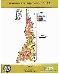
Keywords: coal, energy resources, Pennsylvanian, Raccoon Creek Group, Lower Block Coal Member, Upper Block Coal Member, Buffaloville Coal Member, Brazil Formation, Staunton Formation, Holland Limestone Member
Can't find what you're looking for? Feel free to contact us directly:
Indiana Geological and Water Survey
1001 E. 10th St.
Bloomington, IN 47405
812-855-7636 (phone)
812-855-2862 (fax)
IGWSinfo@indiana.edu
IGS Return Policy
- Original sales receipt required.
- Returns accepted within 30 days of purchase date.
- Refund will be issued by the same method of payment as purchased.
- Products must be returned in the same new condition as purchased.
- Refunds on custom orders and digital products are NOT allowed.
- Customers are responsible for paying shipping costs to return products.
Updated 8/19/2020