

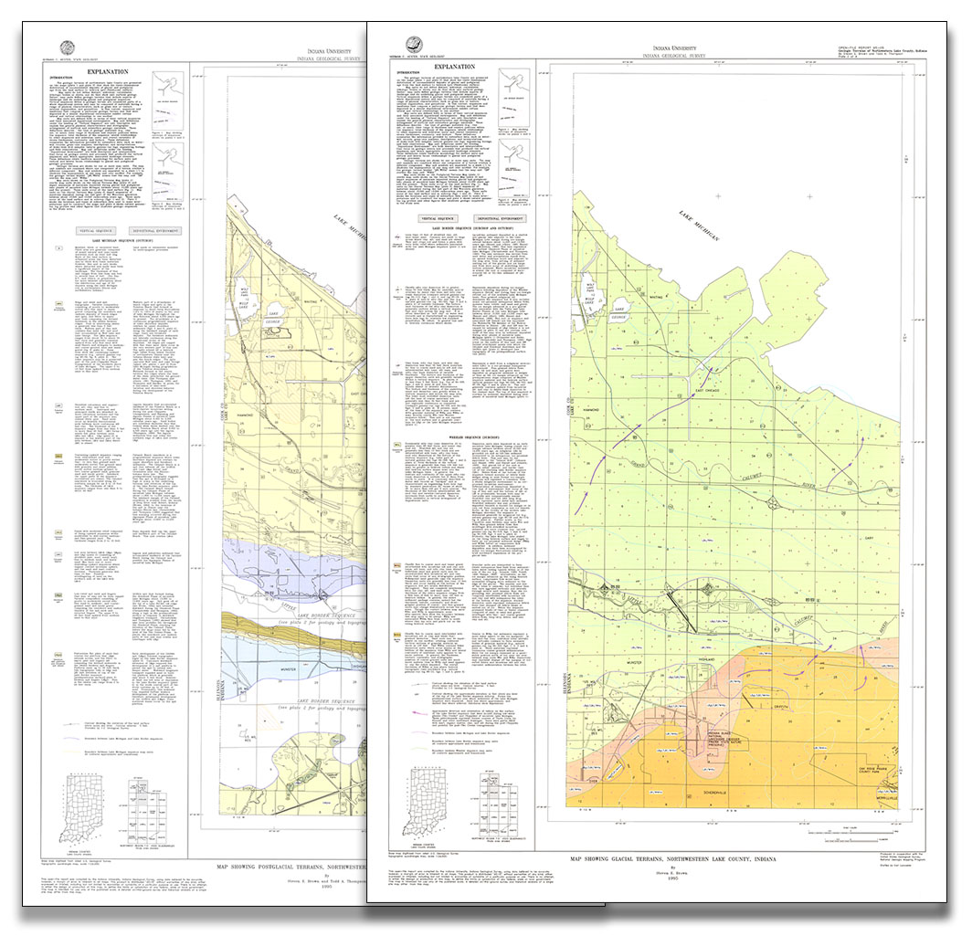
BACKGROUND: The purpose of this report is to provide a background for assessing the relative vulnerability of aquifers (water-bearing formations) to contaminations from the surface or near-surface sources in Porter and LaPorte Counties of northwestern Indiana. This background is provided by maps outlining basic geologic terrain types and the relative levels of intrinsic geologic "sensitivity" associated with each. Glacial terrain and sequences were used previously as a basis fro mapping broad ranges of ground-water sensitivity in Porter County (Bleuer and Woodfield, 1994). The present project utilizes the geologic models developed there to extend map units into LaPorte County. The Porter County report continues to serve as a basic explanation for terrain and sensitivity units mapped within the extended two-county area. The general concepts of terrain units and their origins remain little changed in extension of mapping into LaPorte County; however, the geologic and probably hydrogeologic character of certain units change gradually northeastward into LaPorte County, enough so that definitions of these units are modified and units added, as discussed below.
Bleuer, N. K., Frey, J. D. 1994, Aquifer sensitivity terrain, LaPorte and Porter Counties, Indiana: Indiana Geological Survey Open-File Study 94-06
Notes: Publications in the Indiana Geological Survey Open-File series have been inconsistently named using a variety of series titles including "Open-File Report," "Open-File Map," and "Open-File Study." Prior to 1994, a publication in this series was generally referred to as an "Open-File Report" (but not always). To help reduce confusion created by these inconsistencies, the IGS now refers to every publication in the Open-File series as an "Open-File Study." To be entirely correct in writing a bibliographic reference for a publication, one should use the series name and number that appears on the publication itself.
You may also like:


Keywords: aquifer, map, terrain, Quaternary
Can't find what you're looking for? Feel free to contact us directly:
Indiana Geological and Water Survey
1001 E. 10th St.
Bloomington, IN 47405
812-855-7636 (phone)
812-855-2862 (fax)
IGWSinfo@indiana.edu
IGS Return Policy
- Original sales receipt required.
- Returns accepted within 30 days of purchase date.
- Refund will be issued by the same method of payment as purchased.
- Products must be returned in the same new condition as purchased.
- Refunds on custom orders and digital products are NOT allowed.
- Customers are responsible for paying shipping costs to return products.
Updated 8/19/2020