

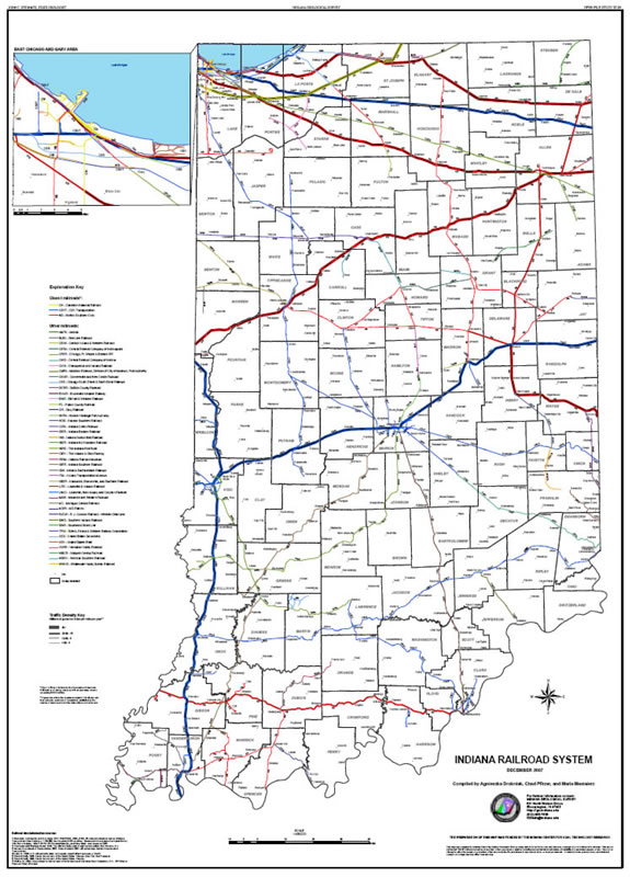
This map shows the Indiana railroad system as of December 2007. Data include active routes, route ownership, and traffic density.
Map scale: 1:400,000
Dimensions: 36" x 50"
Drobniak, A. , Pfitzer, C. M., Mastalerz, M. 2007, Map showing Indiana's railroad system: Indiana Geological Survey Open-File Study 07-04
Notes: The preparation of this map was funded by the Indiana Center for Coal Technology Research.
You may also like:


Keywords: railroad, Indiana, transportation, map, wall map, coal
Can't find what you're looking for? Feel free to contact us directly:
Indiana Geological and Water Survey
1001 E. 10th St.
Bloomington, IN 47405
812-855-7636 (phone)
812-855-2862 (fax)
IGWSinfo@indiana.edu
IGS Return Policy
- Original sales receipt required.
- Returns accepted within 30 days of purchase date.
- Refund will be issued by the same method of payment as purchased.
- Products must be returned in the same new condition as purchased.
- Refunds on custom orders and digital products are NOT allowed.
- Customers are responsible for paying shipping costs to return products.
Updated 8/19/2020