

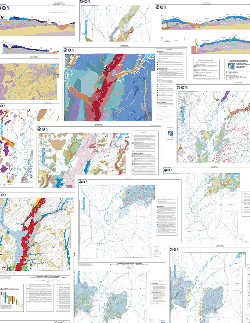
Indiana Geological Survey Open-File Study 00-14, The Hydrogeologic Framework of Marion County, contains digital geologic maps and map explanations in Adobe PDF format (viewable with Adobe® Acrobat® Reader®), digital vector geologic data in ESRI shapefile format, pre-made ESRI ArcView® project files, documentation of geology in a Windows® Help file, a Getting Started manual, and metadata. The entire product is available on CD-ROM; the geologic maps are available separately printed on 35- by 45-inch sheets. This product is intended for geoscientists and educators engaged in surface and subsurface geologic and hydrogeologic investigations of Marion County, Indiana.
PDF-format geologic maps
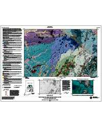
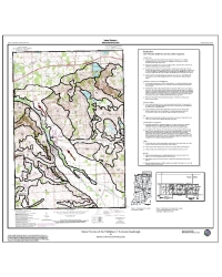
The 11 geologic maps, 2 explanation plates, and 2 cross section plates (all in PDF-format) require a large-format (at least 36-inch-wide) printer or plotter for printing. They can also be ordered individually from the Indiana Geological Survey Publication Sales Office (812-855-7636). Plates 1 and 2 include the explanations for all the geologic maps, plates 3 and 4 are geologic cross sections with their explanation, and plates 5 through 15 are 1:50,000-scale geologic maps. The geologic maps include the geology of the bedrock surface, the pre-Wisconsin surface, two large pre-Wisconsin aquifer complexes, and the late Wisconsin depositional sequences. Hydrogeologic maps of late Wisconsin deposits include maps of the potentiometric surface, water table, and hydrogeologic settings associated with the various glacial terrains and sequences depicted in the geologic maps.ESRI ArcView shapefiles and project files
Each geologic map has been preassembled in ArcView 3.x project files based on ESRI shapefiles. There are 47 themes, such as map unit polygons and elevation contours, that represent the individual components of the geologic maps. The themes can be viewed in any application that can open shapefiles, for example, ESRI ArcView 3.x, ArcMap® 8.x, ArcInfo®, or ArcExplorer®, or Adobe Illustrator® with the MAPublisher® plug-in by Avenza. The preassembled ArcView 3.x project files contain the correct theme layering, and color and pattern legends that match the map explanations in the PDF documents and the Help file.Windows Help file
The Windows Help file only requires the Windows operating system to run. It works like any other Help file typically available with software. It is also available in the ArcView project files included on the CD-ROM under the ArcView Help menu. The Help file- describes the general characteristics and significance of the particular features shown on the corresponding geologic map(s),
- includes an explanation for all geologic maps,
- provides a glacial geologic history of the White River Valley, and
- provides a guide to the digital data on the CD-ROM.
System requirements
- Microsoft Windows® 9x, NT, 2000, or XP to view the Help file.
- Adobe Acrobat Reader® 4.0 or later to view and print the PDF files.
- Software that imports shapefiles, such as ArcView, ArcMap, ArcInfo, ArcExplorer, or Adobe Illustrator with MAPublisher Plug-in by Avenza.
- ArcView 3.x to view the project files.
- 150 megabytes of free hard drive space if you intend to copy the CD contents to your hard drive.
Brown, S. E., Laudick, A. J. 2003, Hydrogeologic framework of Marion County, Indiana: a digital atlas illustrating hydrogeologic terrain and sequence: Indiana Geological Survey Open-File Study 00-14, 15 pl.
Notes: Publications in the Indiana Geological Survey Open-File series have been inconsistently named using a variety of series titles including "Open-File Report," "Open-File Map," and "Open-File Study." Prior to 1994, a publication in this series was generally referred to as an "Open-File Report" (but not always). To help reduce confusion created by these inconsistencies, the IGS now refers to every publication in the Open-File series as an "Open-File Study." To be entirely correct in writing a bibliographic reference for a publication, one should use the series name and number that appears on the publication itself.
The CD-ROM includes 11 geologic maps, 2 explanation plates, and 2 cross section plates (all in PDF format) that require a large-format (at least 36-inch-wide) printer or plotter for printing. They can also be ordered individually:
Explanation Plates and Cross Sections
- Plate 1: Hydrogeology, Pre-Wisconsin Glacial Geology, and Bedrock Geology and Topography Maps
- Plate 2: Late Wisconsin Glacial Geology Maps
- Plate 3: Geologic Cross Sections
- Plate 4: Cross Sections and Cross Sections Explanation
County-Scale (1:50,000) Geologic Maps
- Plate 5: Geology and Topography of the Bedrock Surface
- Plate 6: Geology and Topography of the Pre-Wisconsin Surface
- Plate 7: Geology of Late Wisconsin Glacial Deposits: Lower and Total Sequences
- Plate 8: Geology of Late Wisconsin Glacial Deposits: Upper Sequence
- Plate 9: Thickness of Unconfined Sand and Gravel
- Plate 10: Glacial Terrains
- Plate 11: Potentiometric Surface and Hydrogeologic Settings of the Shallow Aquifer System
- Plate 12: Geology of the Fall Creek Aquifer Complex
- Plate 13: Potentiometric Surface and Hydrogeologic Settings of the Shallow Aquifer System
- Plate 14: Geology of the Southwestern Aquifer Complex
- Plate 15: Potentiometric Surface and Hydrogeologic Settings of the Southwestern Aquifer Complex
You may also like:

Keywords: statemap, glacial geology, GIS, ESRI ArcView, geologic map, hydrogeology, Quaternary
Can't find what you're looking for? Feel free to contact us directly:
Indiana Geological and Water Survey
1001 E. 10th St.
Bloomington, IN 47405
812-855-7636 (phone)
812-855-2862 (fax)
IGWSinfo@indiana.edu
IGS Return Policy
- Original sales receipt required.
- Returns accepted within 30 days of purchase date.
- Refund will be issued by the same method of payment as purchased.
- Products must be returned in the same new condition as purchased.
- Refunds on custom orders and digital products are NOT allowed.
- Customers are responsible for paying shipping costs to return products.
Updated 8/19/2020