

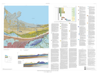
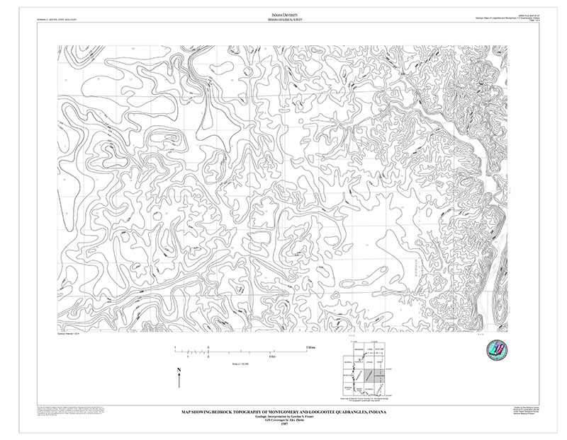
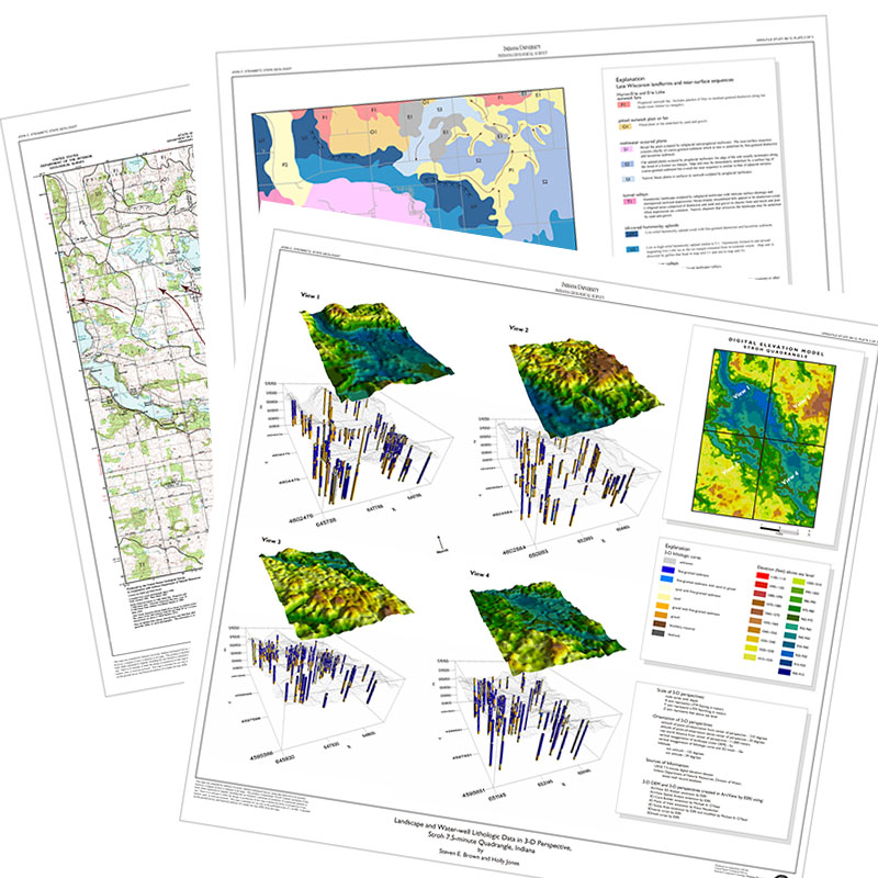
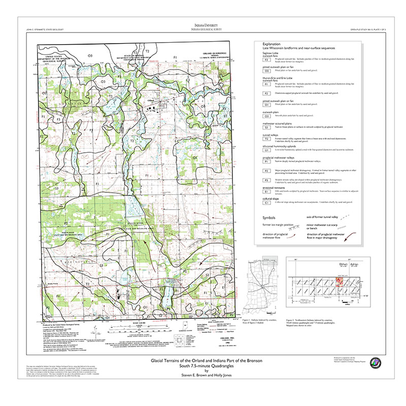
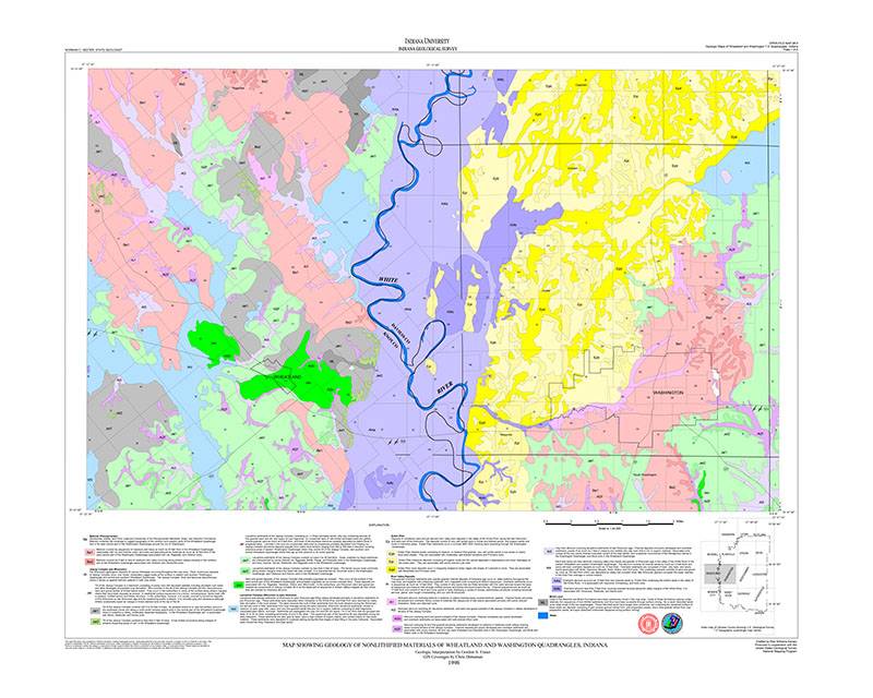
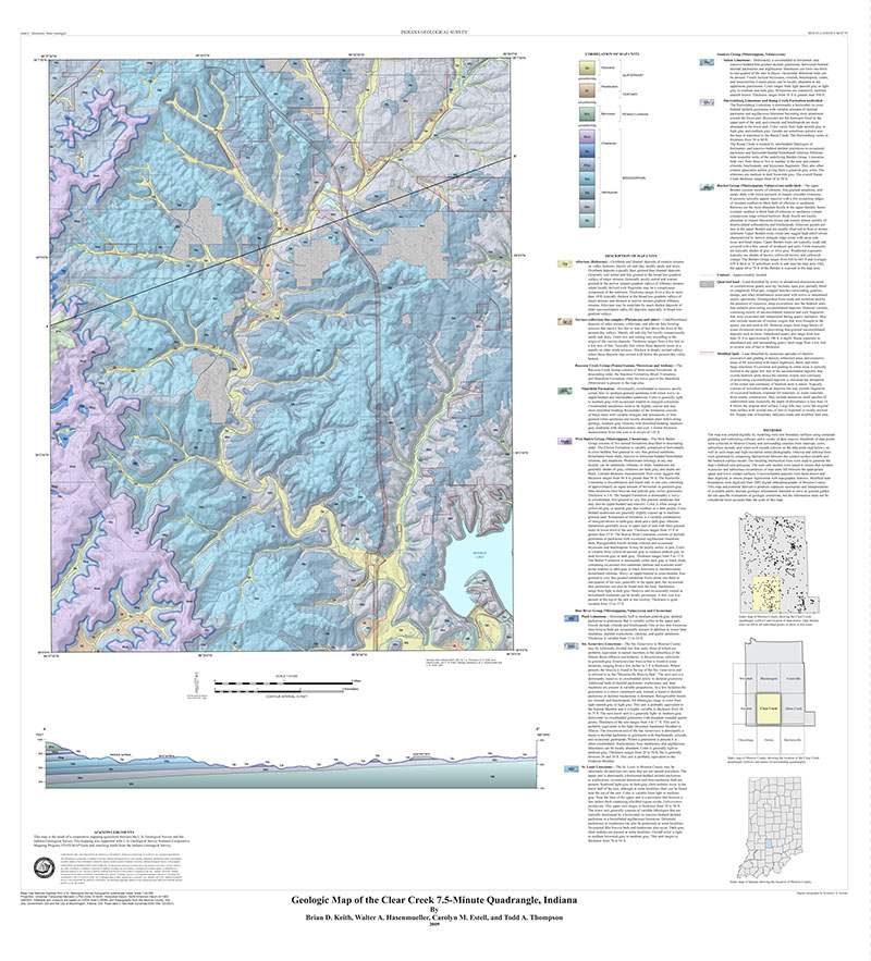
Map units define geologic terrains that include aspects of landscape and underlying depositional sequences. Map-unit boundaries are based primarily on geomorphology and secondarily on lithology. Vertical sequences within a geologic terrain are considered parts of a whole depositional system and may be composed of materials having a range of physical characteristics such as grain size or texture, internal organization, and geometries. In this context, sequences and landforms that compose a particular geologic terrain and that were deposited in a similar depositional environment exhibit certain lateral and vertical relationships to one another. Map-unit definitions are both descriptive and interpretive. Descriptions include the type of geologic materials (for example, clay, silt, or sand); their range in thickness and relative positions within the sequence; total thickness of the sequence; lateral relations to other sequences and individual units; and overall variability of strata thicknesses, continuity, and texture. These definitions summarize the information provided by subsurface data such as water-well records; grain-size analyses, descriptions, and interpretations of down-hole drill and vibracore samples; natural gamma-ray logs; engineering borings; and field observations. Interpretations focus on geologic events and processes that produced the vertical sequences and, where appropriate, associated landscape elements. Interpretations relate landform morphology of surface units and vertical and lateral facies relationships to glacial and postglacial geologic processes. The map-unit descriptions also apply to the geologic cross sections. The cross sections include additional geologic units that are only in the subsurface and, therefore, are not shown on the map or correlation diagram. These units are Qtt of the Lake Michigan sequence
Brown, S. E., and Thompson, T. A., 2005, Geologic map of glacial and post-glacial deposits, northern Lake County, Indiana: Indiana Geological Survey Miscellaneous Map 71, scale 1:40,000.
You may also like:
Keywords: statemap, glacial, geologic map, cross section, 3D map, Lake Michigan Sequence, Lake Border Sequence, Wheeler Sequence
Can't find what you're looking for? Feel free to contact us directly:
Indiana Geological and Water Survey
1001 E. 10th St.
Bloomington, IN 47405
812-855-7636 (phone)
812-855-2862 (fax)
IGWSinfo@indiana.edu
IGS Return Policy
- Original sales receipt required.
- Returns accepted within 30 days of purchase date.
- Refund will be issued by the same method of payment as purchased.
- Products must be returned in the same new condition as purchased.
- Refunds on custom orders and digital products are NOT allowed.
- Customers are responsible for paying shipping costs to return products.
Updated 8/19/2020